Area - traffic density results
This kind of report will provide you with the probe number for every segment only instead of the full report.
Keep in mind: Analysis results are available for two years. After two years, the report will expire. We strongly recommend saving the results on your device or cloning the report to maintain the results for a longer time.
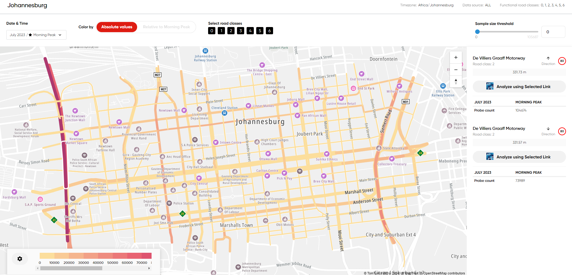
Example of area results visualization:
For the Area Analysis, there are three formats of downloads available: GeoJSON, JSON and ZIP file.
In the output, the following statistics are delivered:
- Length of each segment
- Functional Road Class of each segment
- Sample size (hits)
- Street name
- Speed limit
- MultiNet segment ID
- MultiNet-R segment ID
Please find the details of the available formats below:
GeoJSON GeoJSON is a format for encoding a variety of geographic data structures.
JSON The JSON file contains all information presented in the DBF files delivered in the ZIP file but presented in the respective format. Please refer to the DBF section below for the related description.
ZIP file The compressed file delivers the Shapefile (Esri format) with route geometry and DBF tables corresponding to the time sets pre-defined in the analysis.