Area - full report results
Keep in mind: Analysis results are available for two years. After two years, the report will expire. We strongly recommend saving the results on your device or cloning the report to maintain the results for a longer time.
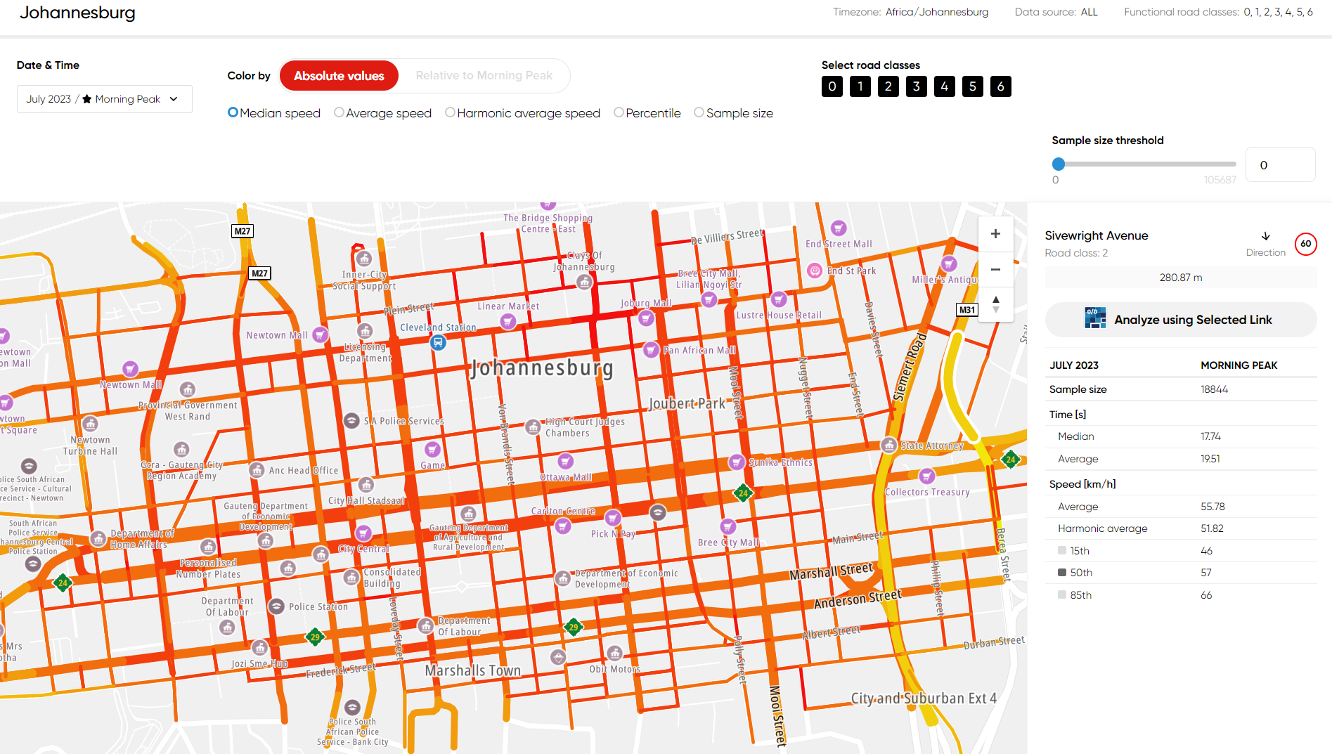
Example of area results visualization - Absolute values:
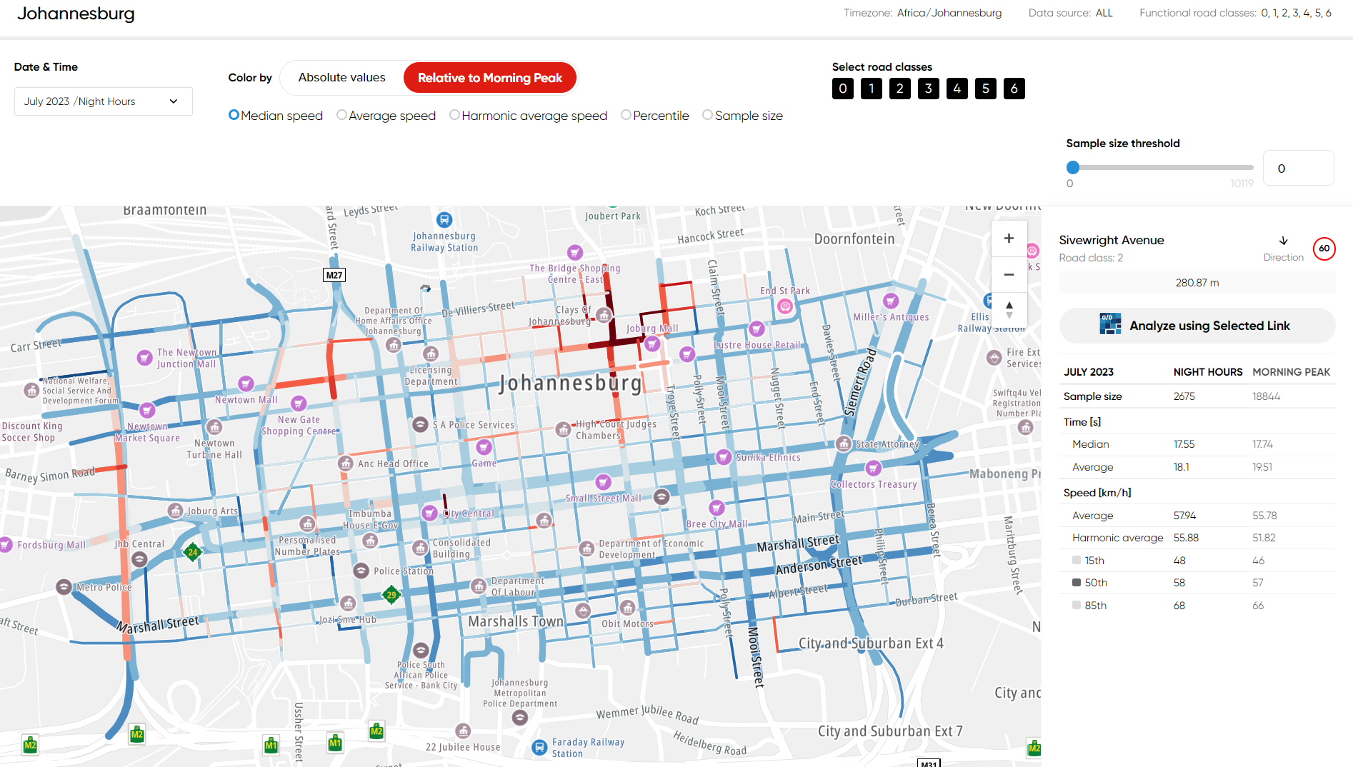
Example of area results visualization - Relative to a base set:
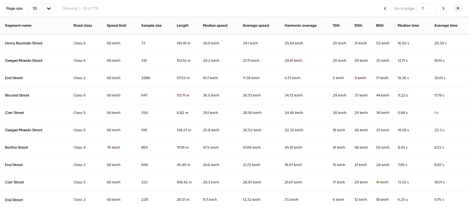
Segment list of the area analysis:
For the Area Analysis, there are three formats of downloads available: GeoJSON, JSON and ZIP file.
In the output, the following statistics are delivered:
- Length of each segment
- Functional Road Class of each segment
- Average travel time (harmonic)
- Median travel time (harmonic)
- Travel time ratio (shows the ratio of travel time in the current time set to travel time in the base set)
- Average speed (arithmetic)
- Median speed (arithmetic)
- Standard deviation of the speed
- Sample size (hits)
- Street name
- Speed limit
- MultiNet segment ID
- MultiNet-R segment ID
- 5th percentile, 10th percentile, ..., 90th percentile, 95th percentile of the travel time
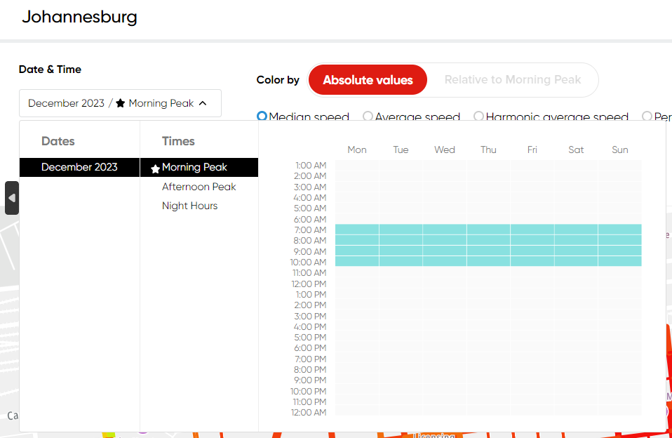
In each Traffic Stats report, one of the time sets is marked as a Base set, indicated by a black star. When you have more than one time set in the analysis, the travel time ratio shows you a comparison of a given time set to the base one.
Important: In the response, there can be two results with the same segment ID: one with a negative value (with a minus sign) and the corresponding positive value, which indicates two directions.
Please find the details of the available formats below:
GeoJSON GeoJSON is a format for encoding a variety of geographic data structures.
JSON The JSON file contains all information presented in the DBF files delivered in the ZIP file but presented in a human-readable text format. Please refer to the DBF section below for the related description.
ZIP file The compressed file delivers the Shapefile (Esri format) with route geometry and DBF tables corresponding to the time sets pre-defined in the analysis.
A Shapefile with the geometry and DBF files containing the actual speed and travel time data for each road segment is provided. This information is available per the direction of travel. This product is ideal for the support of traffic modeling, strategic decisions, and other more advanced applications that require knowledge of average speeds driven throughout an entire region.
The results are provided in an industry-standard Esri Shapefile format containing the geometry of the road segments and a set of additional Dbase files containing the statistics per road segment. A GIS tool can analyze and visualize the results, there are many software vendors to choose from and there are also free GIS software packages available. More information about the Esri Shapefile format can be found in the ESRI Shapefile Technical Description document published on the Esri website: