Geopolitical view
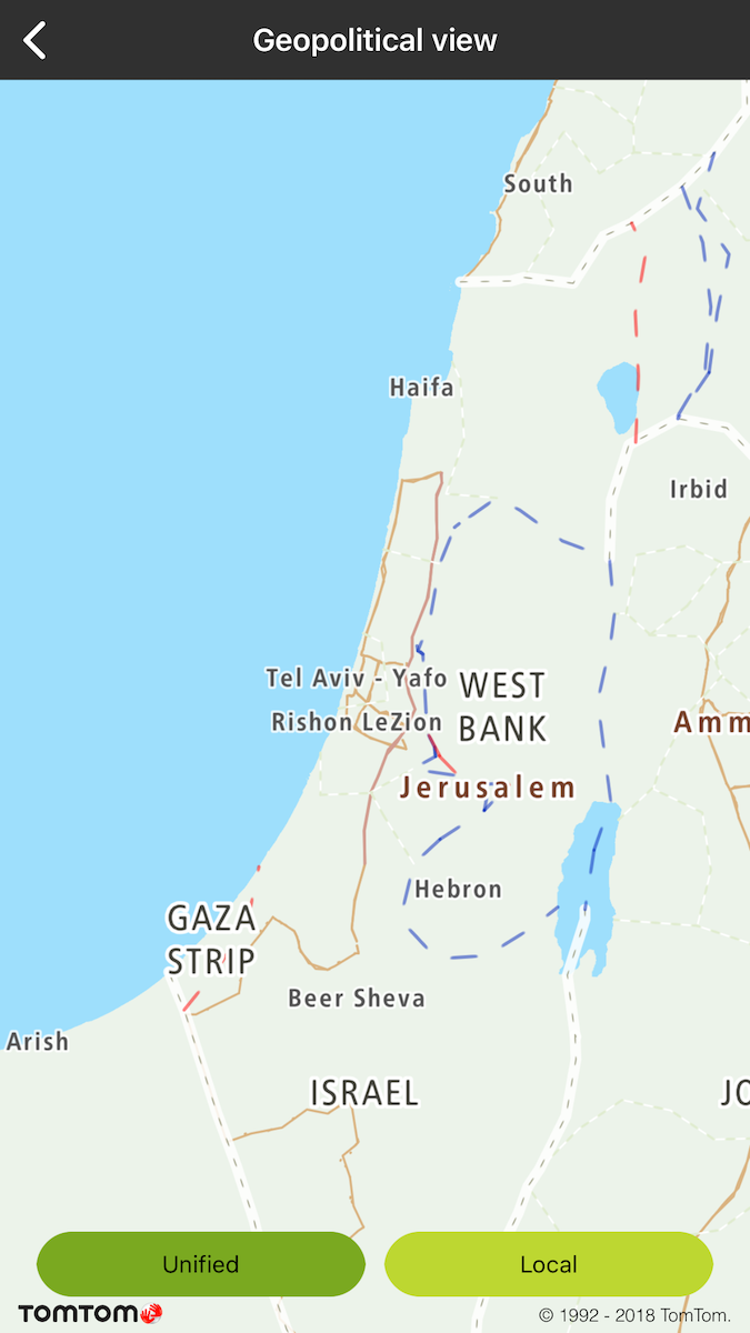
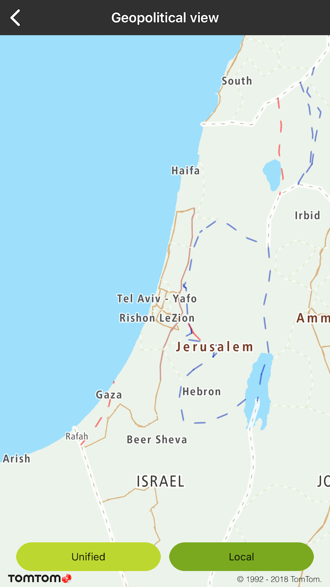
Allow your user to see the map boundaries based on international or local country views. The local view is available for a particular area of the world that is considered as disputed by two or more countries. As a result, each country can show this area as a part of his country. List of the supported views can be found at Default View Mapping.
Sample use case: You want to display the local map view for Israel.
To change the geopolitical view for the map:
Israel international view |
Israel local view |