Traffic and alerts on the route
Overview
Users receive information about the traffic and are alerted to events on their route.
Events along the route
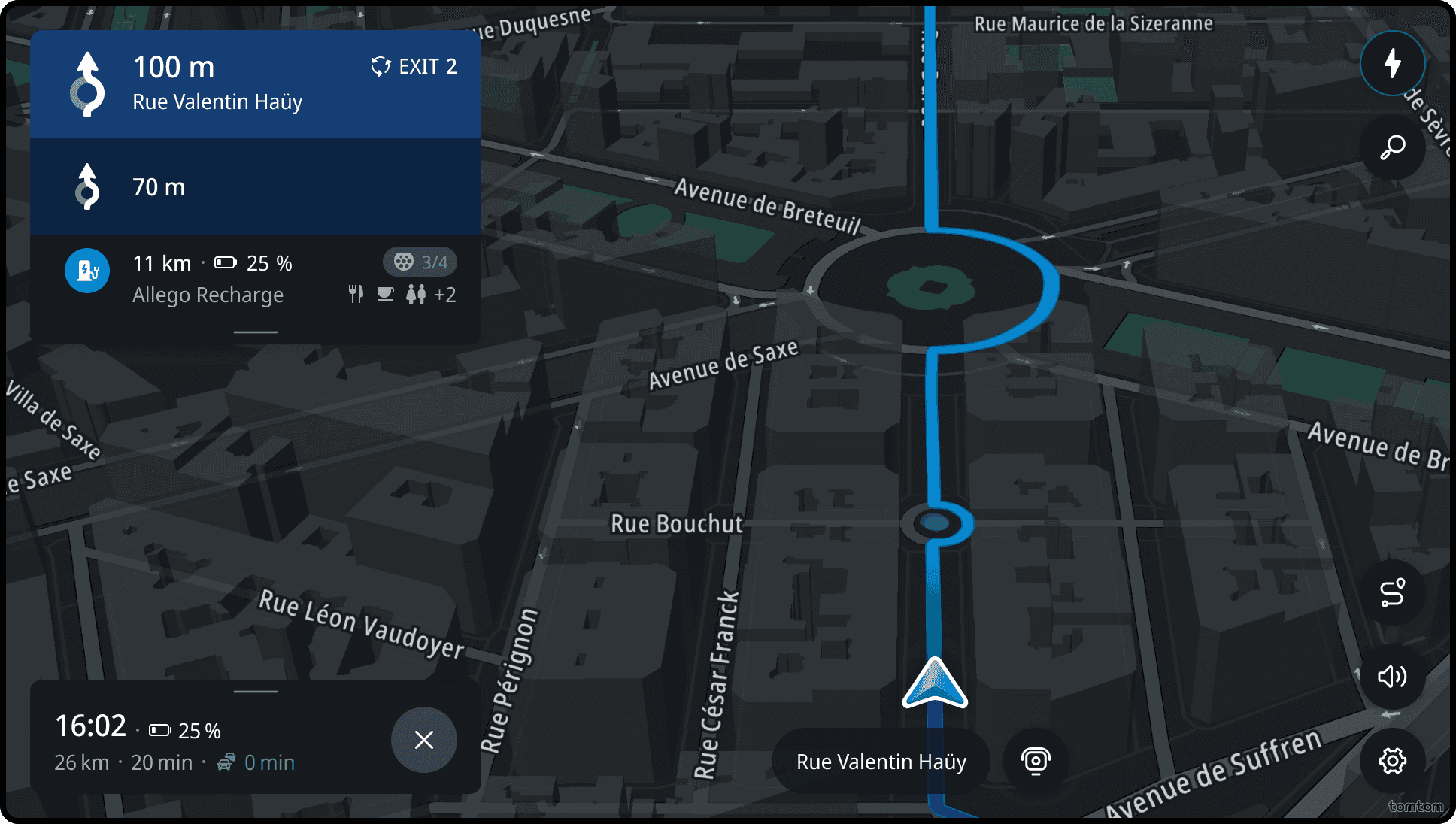
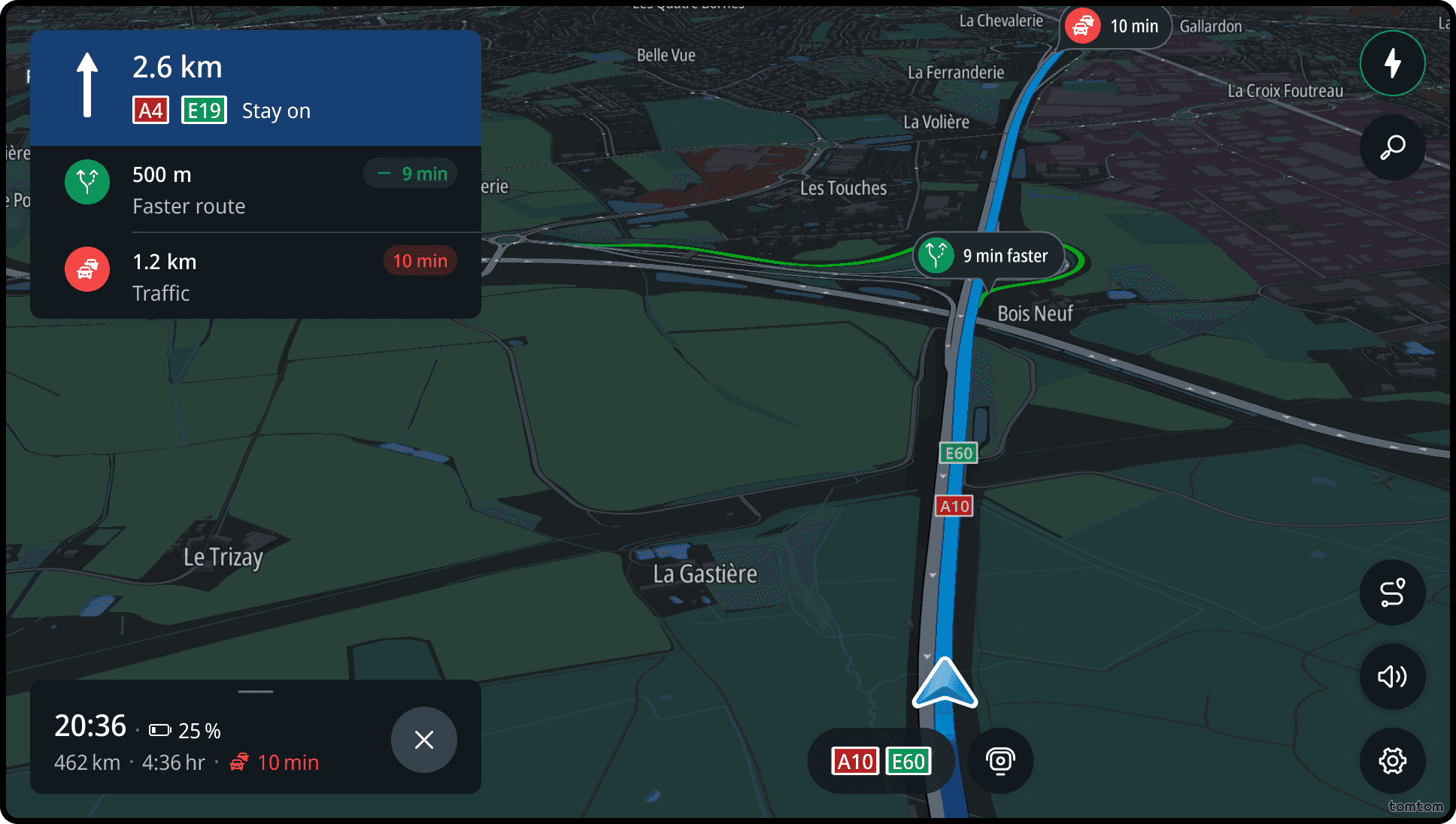
All important events the driver may encounter are visualized on the map and in the horizon panel on the side.
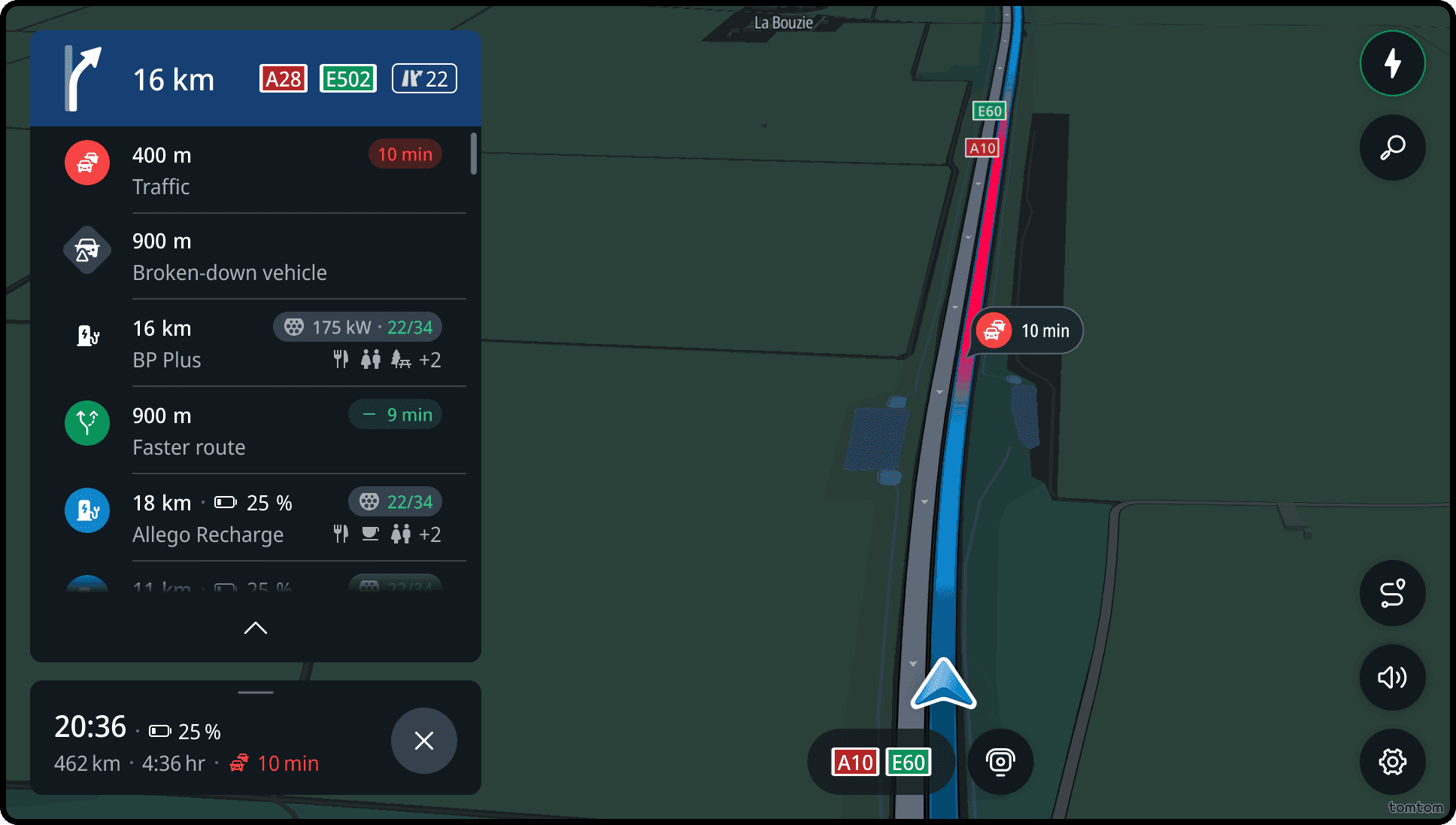
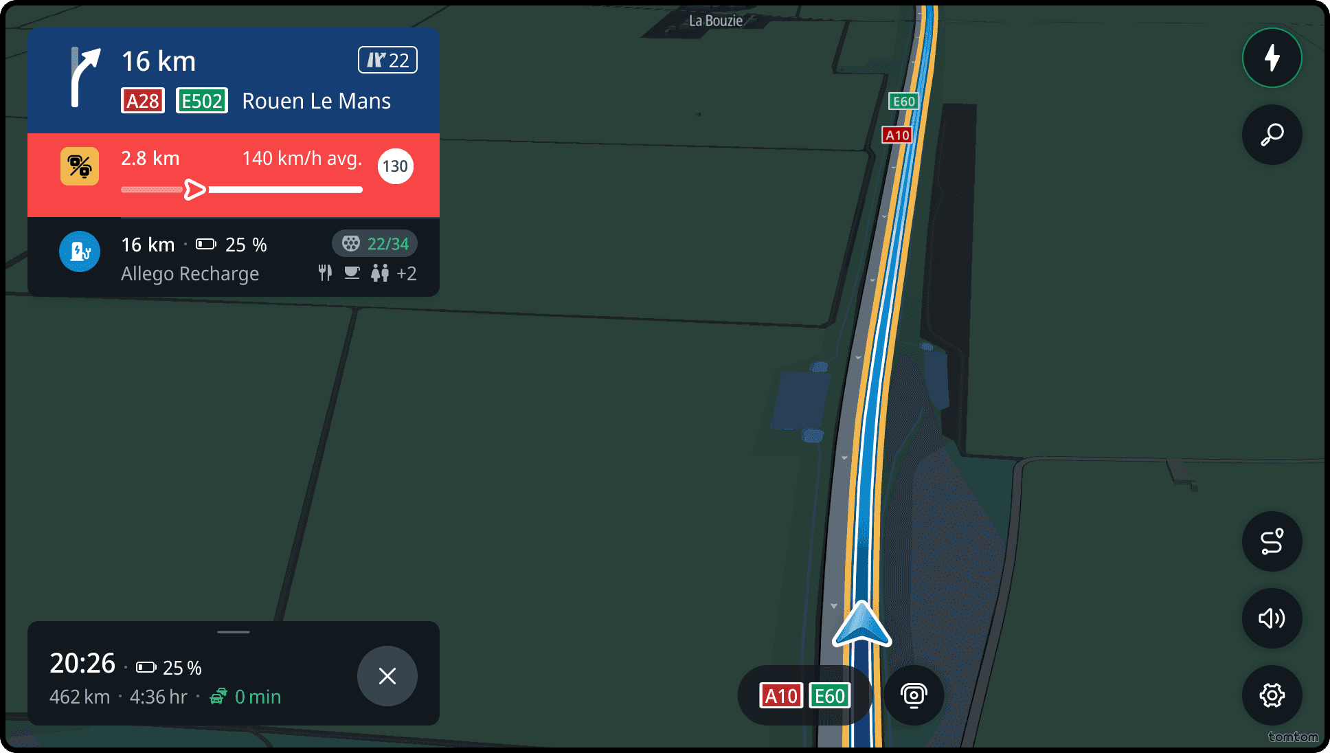
The horizon panel provides advance information about the two upcoming events along the route, such as charging points, upcoming rest areas, speed cameras, and fuel stations. Events within 10 km distance are displayed chronologically in the horizon panel, with the exception of the upcoming planned stop, which remains visible beyond this distance threshold.
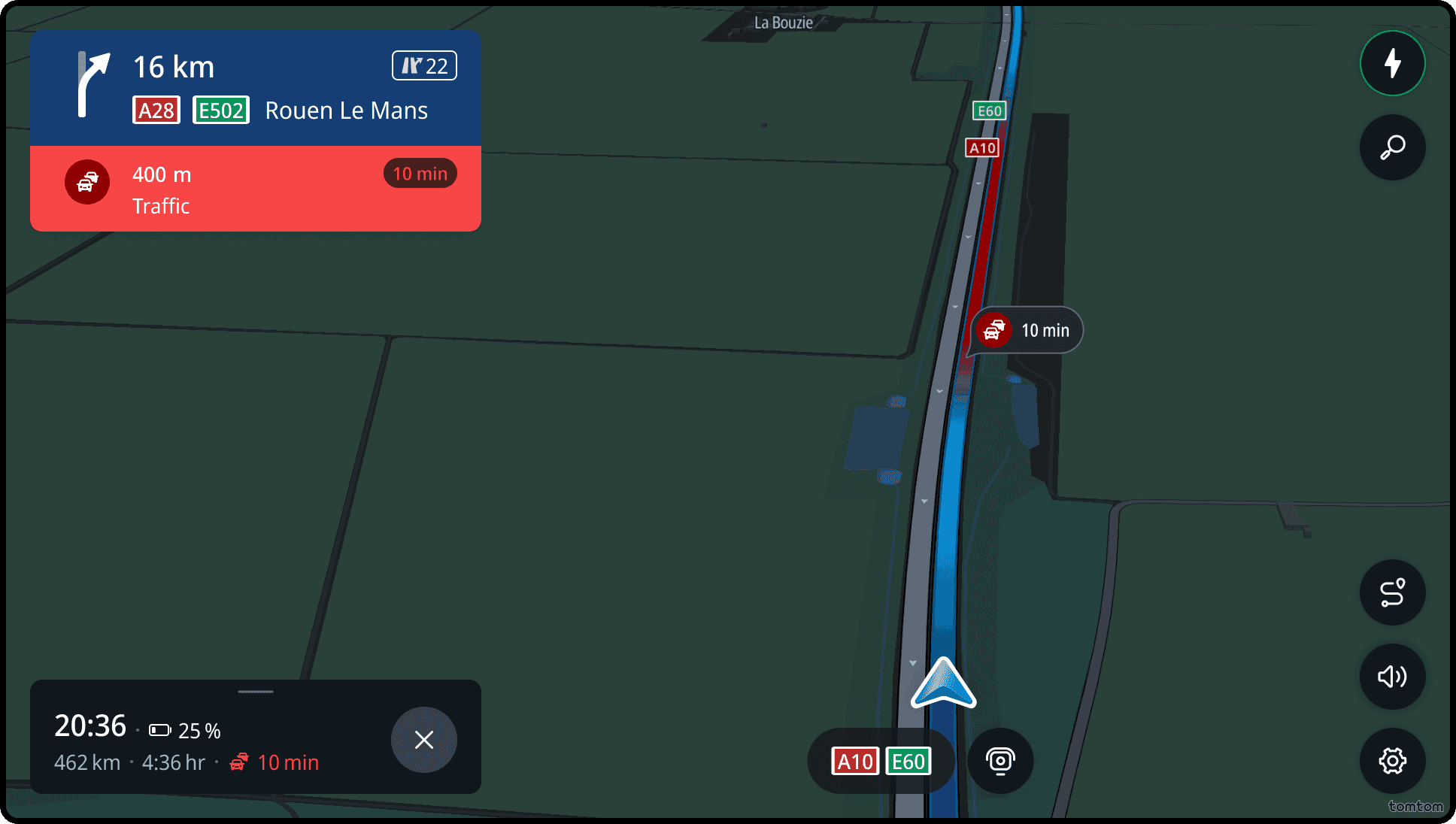
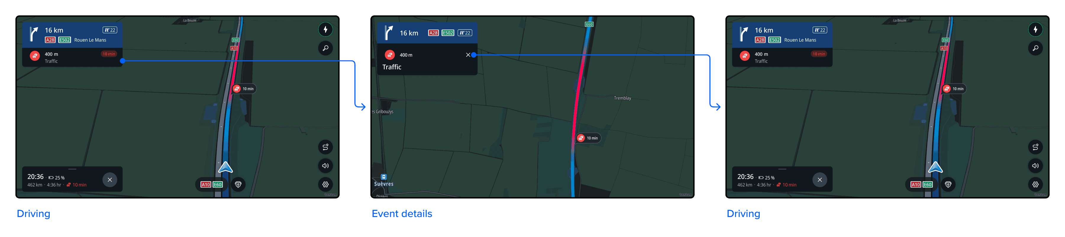
All events are tappable and show more information when selected. (See Traffic and delay for more information.)
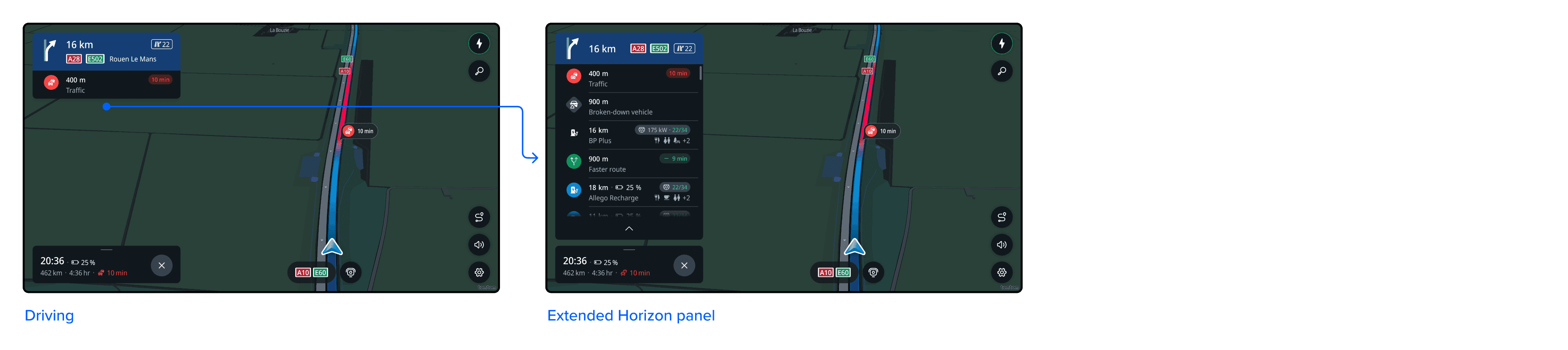
Show more upcoming information
Drivers are able to manually extend the horizon panel to view upcoming events further down the route.
All events along the route for the upcoming 35 km are shown in chronological order, allowing the user to scroll through them.
Drivers can manually collapse the horizon panel by tapping the handle bar or swiping up the horizon panel. When collapsed, only a maximum of two events will be shown.
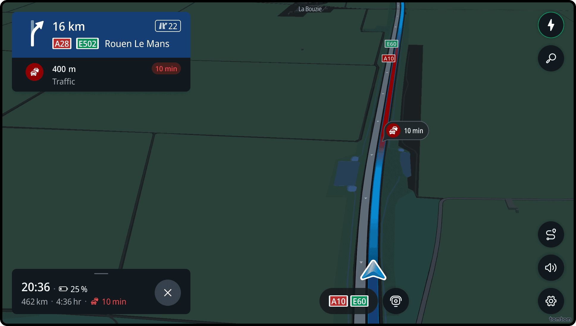
Traffic and delay
Traffic delays are shown when drivers are still far from the actual location, giving them time to prepare.
There are 3 traffic severities, and they are represented by a specific colour in the icon and on the map:
| Icon | Traffic severity |
|---|---|
| Slow moving traffic | |
| Heavy traffic | |
| Stationary traffic |
The traffic delay information is shown in the event card alongside the distance to the event.
Jam tail warning
For safety reasons, drivers are alerted when approaching the end of a traffic jam (especially in high-speed situations). This way, they can slow down in time and avoid a potential accident.
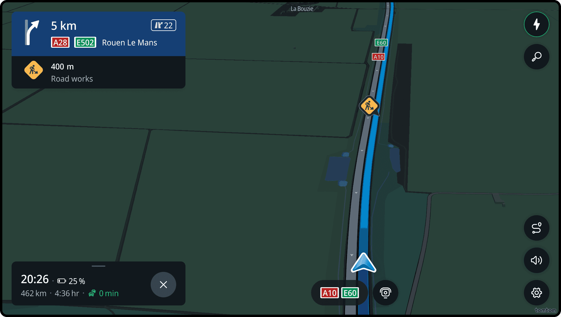
Road works
Drivers are alerted as they approach road works.
If the road works cause traffic delays, this is also shown in the event card.
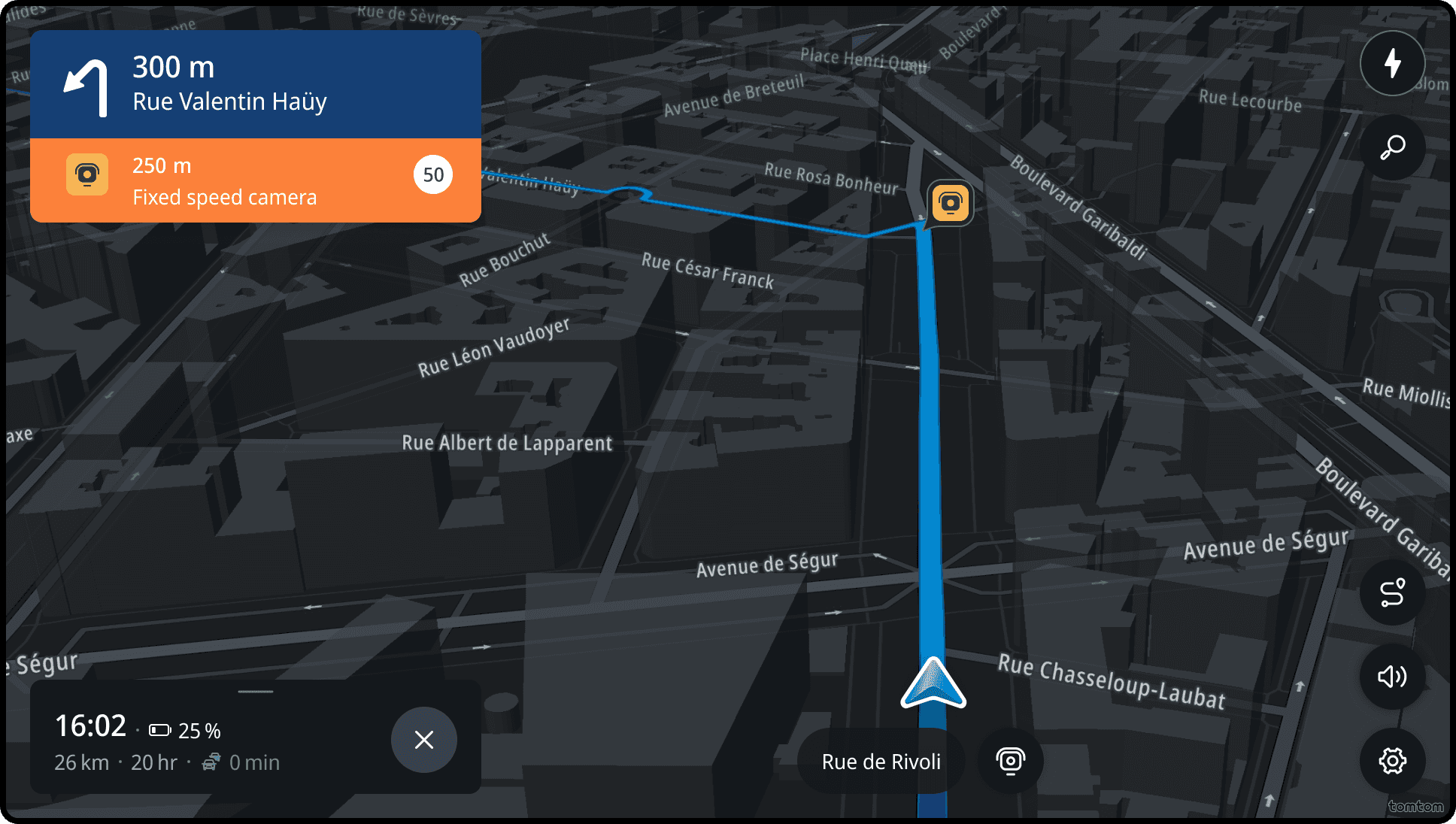
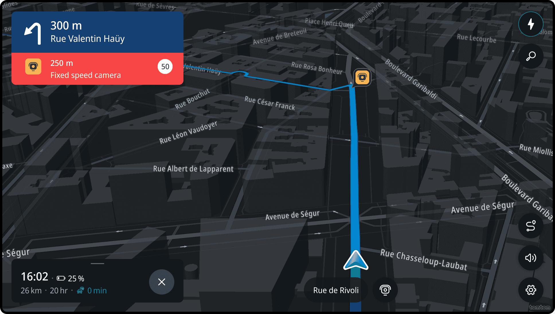
Safety cameras
Drivers are alerted as they approach safety cameras. These include speed cameras (both fixed and mobile), average speed zones, red-light cameras, and restriction cameras.
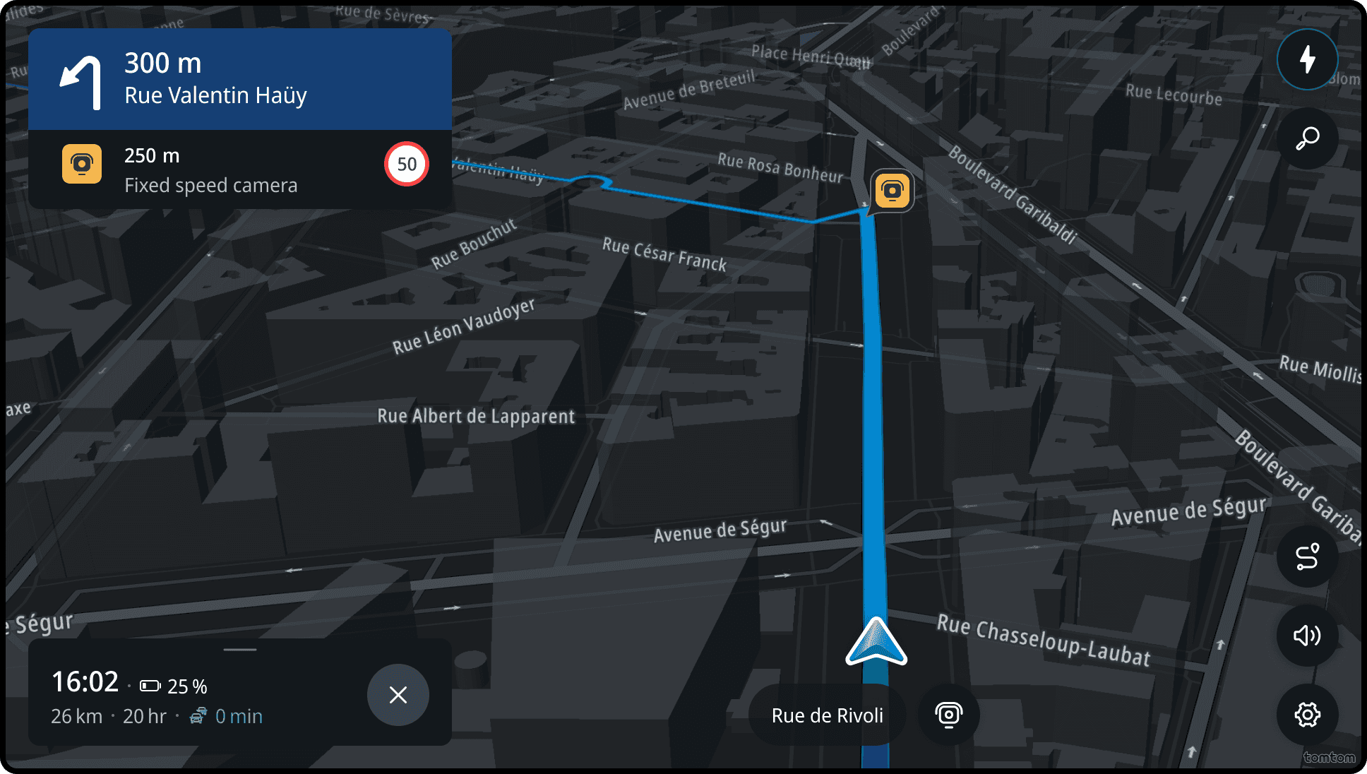
If a driver is speeding up to 5km/h above the speed limit near a camera, the event panel is highlighted orange.
If a driver is speeding up more than 5km/h above the speed limit near a camera, the event panel is highlighted red.
When drivers enter the average speed zone, a progress bar is shown, indicating the remaining distance and the current driver's average speed.
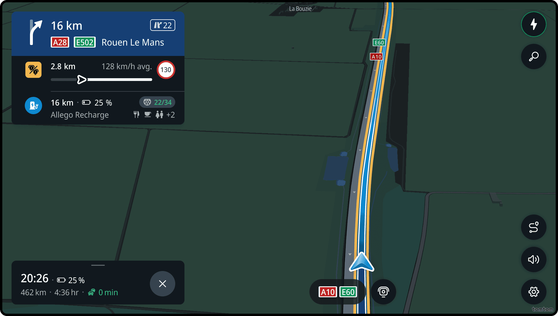
If the average speed of the driver is up to 5km/h above the speed limit, the event panel is highlighted orange.
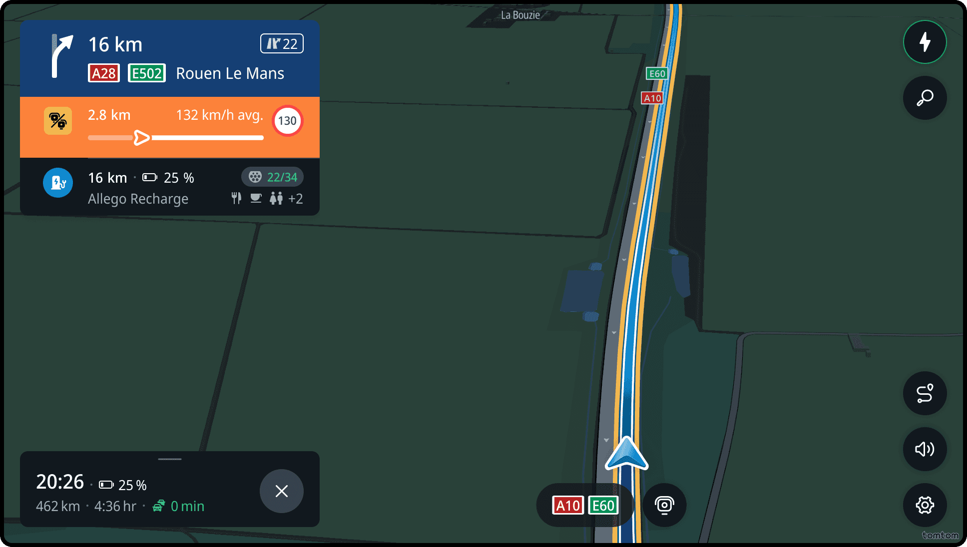
If the average speed of the driver is more than 5km/h above the speed limit, the event panel is highlighted red.
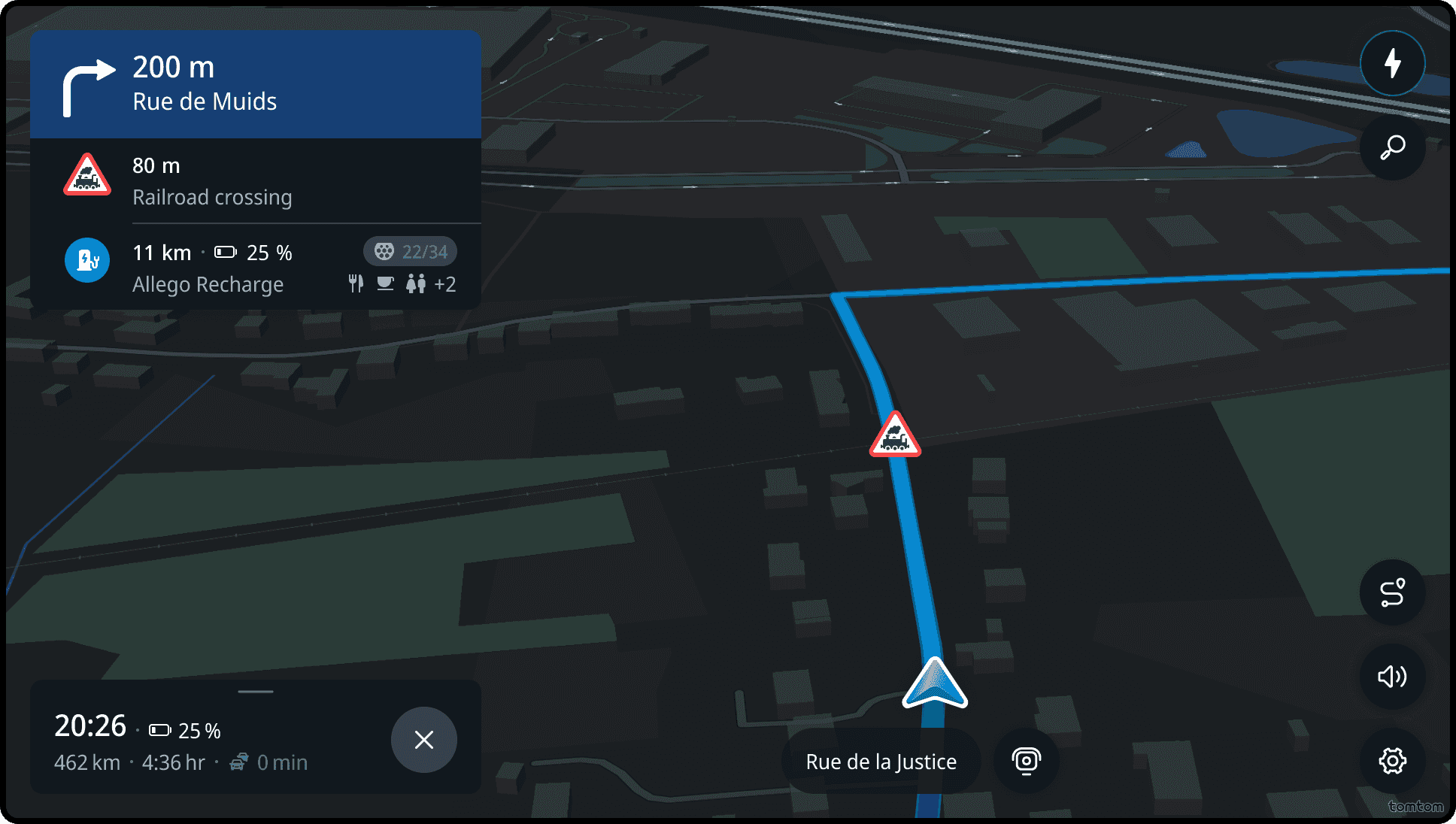
Railroad crossings
Drivers are alerted to railroad crossings when approaching them, so they can take extra caution and stop if necessary.
The warning sign reflects the real-world road sign.
| Icon | Railroad type |
|---|---|
| Railroad crossing (Europe) | |
| Railroad crossing (Japan) | |
| Railroad crossing (US) |
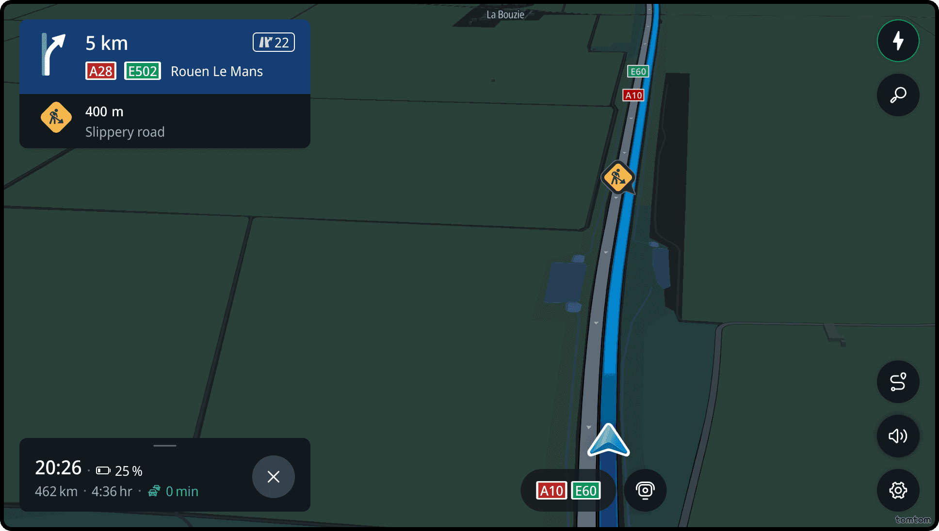
Hazards
Drivers are alerted to hazardous events along the way, such as traffic incidents (accidents, broken-down vehicles and wrong-way driver), weather hazards (heavy rain, fog, reduced visibility, slippery road and strong wind), and road hazards (bad surface conditions, animals on the road, people on the road and objects on the road).
All events are visualised in the horizon panel. But only accidents, bad road conditions, broken-down vehicles, objects on the road and wrong-way driver events are visualised on the map.
The warning icon reflects the hazard type.
| Icon | Hazard type |
|---|---|
| Accident | |
| Animals on the road | |
| Bad road conditions | |
| Broken-down vehicle | |
| Fog | |
| Heavy rain | |
| Jam-tail warning | |
| Slippery road | |
| Strong wind | |
| Objects on the road | |
| People on the road | |
| Wrong-way driver |
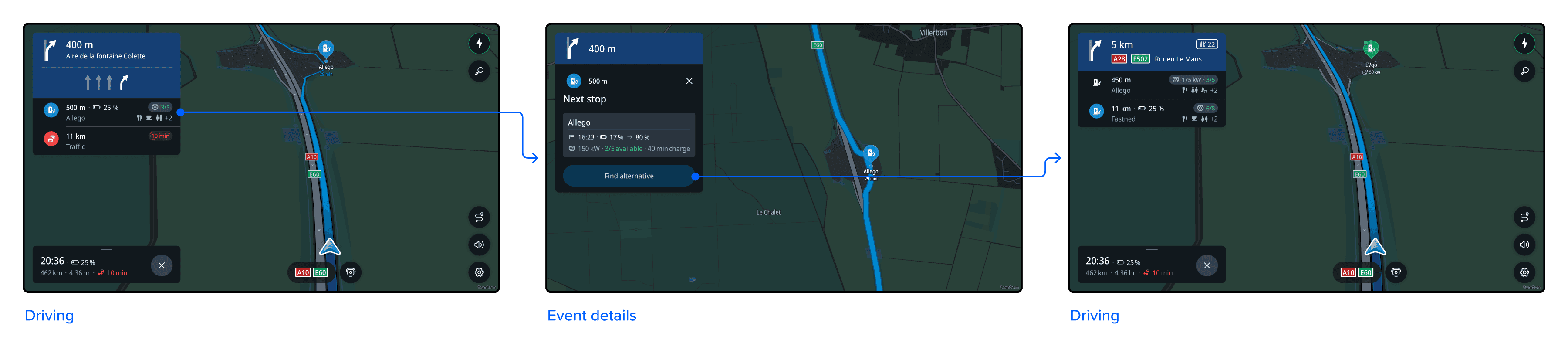
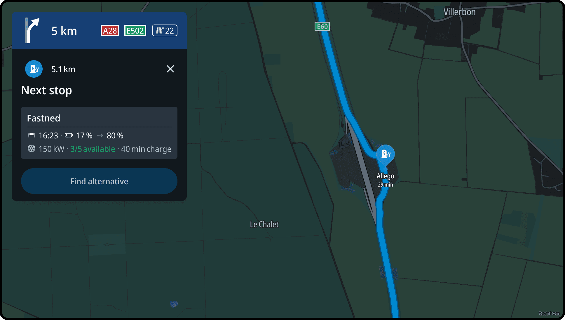
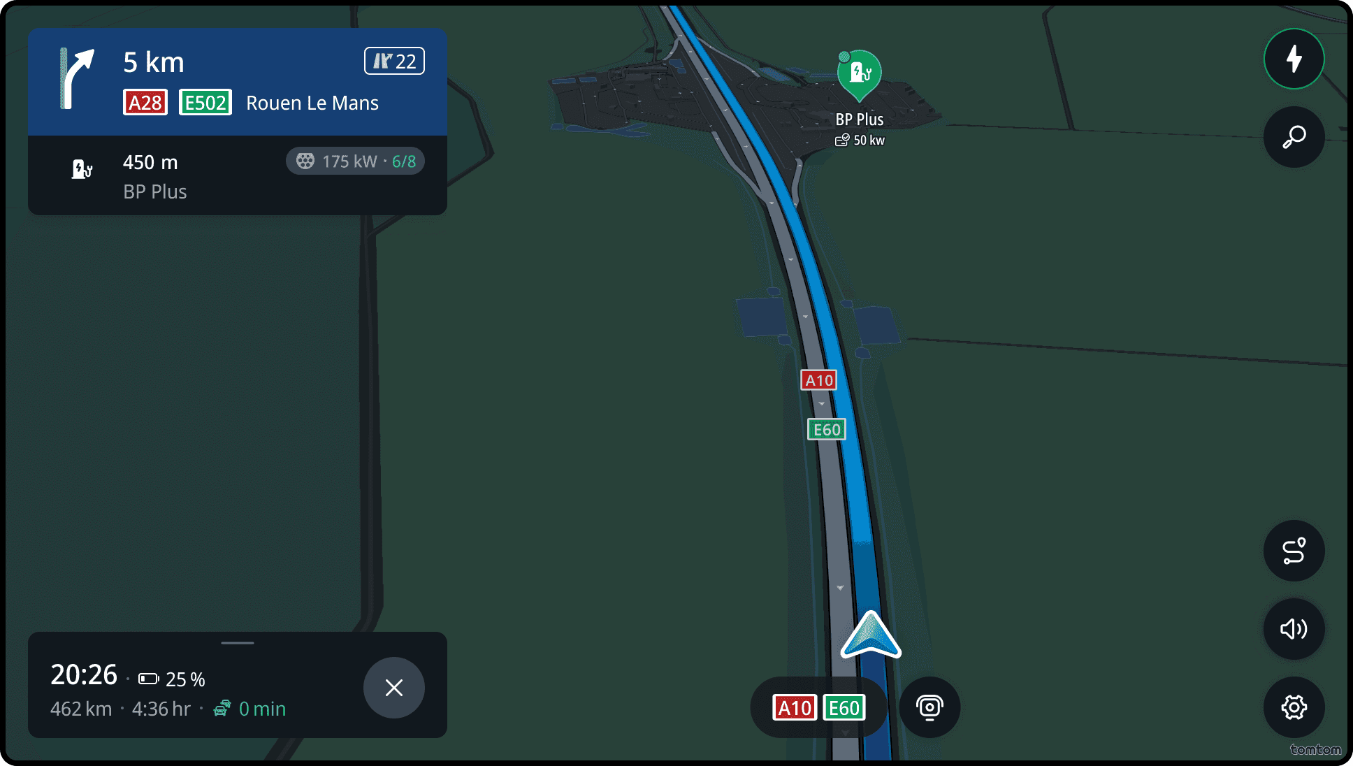
Horizon event – next charging stop
When a route includes charging stops, the next charging stop is shown in the horizon panel.
The panel displays estimated charging time, battery level on arrival, and charger availability at the station.
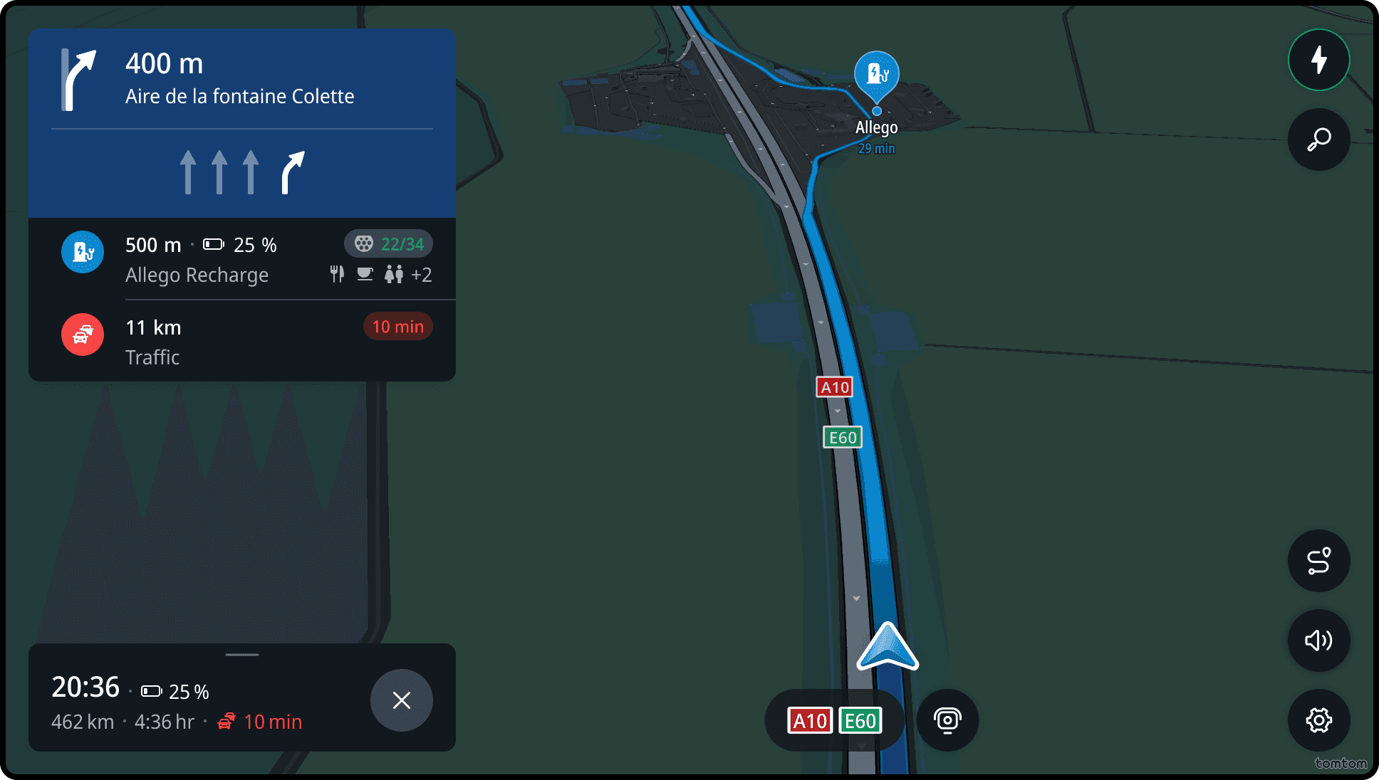
Horizon event – charging stations
Charging stations are suggested along the route for EV drivers. Availability is based on the compatible charger with the highest charging speed.
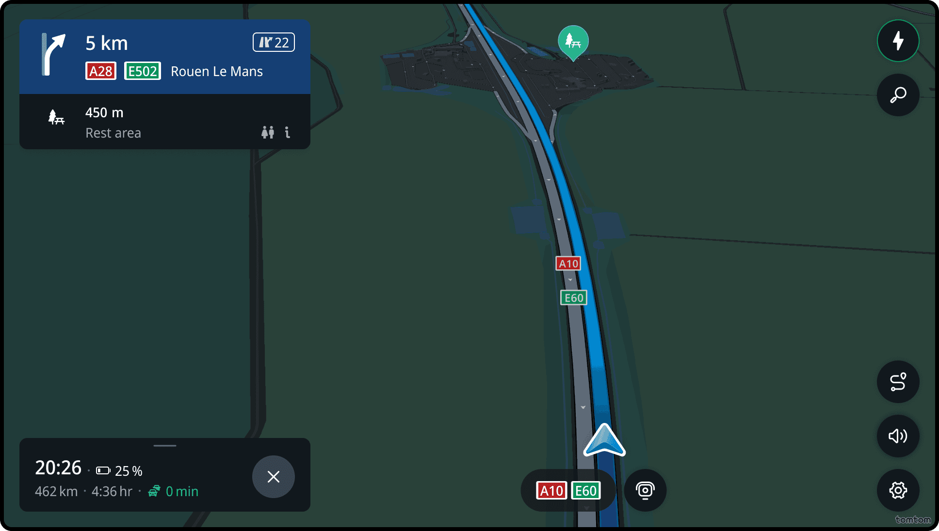
Horizon event – rest area
Rest areas show amenities such as parking lots, restaurants, petrol stations, and charging stations.
For charging, the availability is shown for the compatible charger with the highest speed.
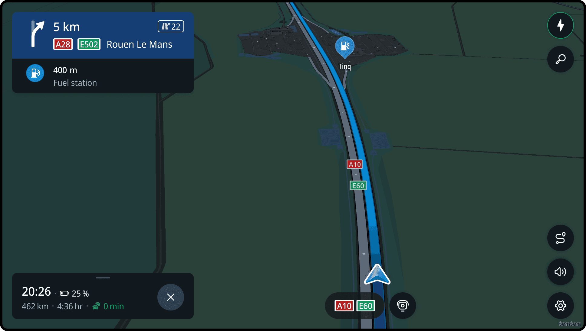
Horizon event – petrol stations
For ICE vehicles, upcoming petrol stations along the route are displayed.
Interact while driving
From the map, users can perform the following actions:
- Change the view to route overview
- Report a speed camera
- Mute guidance sounds and alerts
- Toggle between map views: 3D Direction Up, 2D Direction Up, or 2D North Up
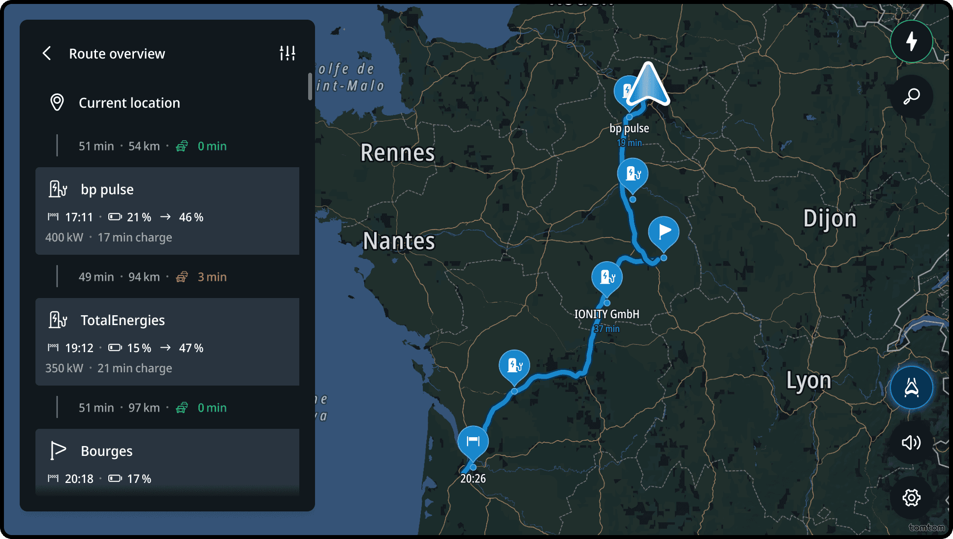
In the route overview, drivers can view the complete itinerary with all stops. The map zooms out to show the remaining route.
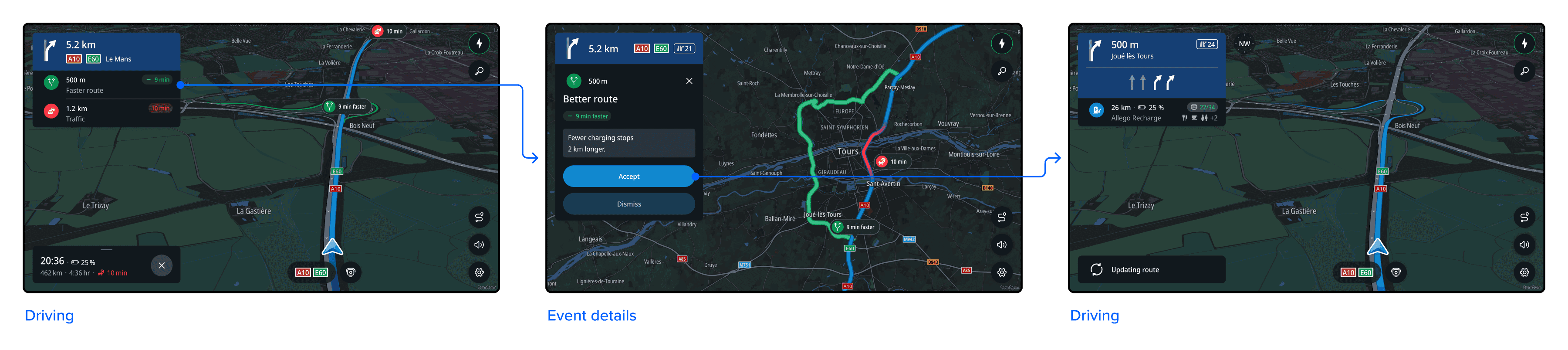
Better route proposal
If auto rerouting is turned off, the driver will be notified when a better route is available.
Drivers can accept the new route by steering in that direction or tapping the event to view more details.
If auto rerouting is turned on, the new route is applied automatically, and the driver is notified of the changes afterward.
Flows
Extending the horizon panel
When tapping on the handle bar or swipping down the horizon panel, the panel extends.
Zoom in on the traffic and delay
When tapping a traffic event, the event details panel opens. The map zooms in on the traffic tube.
View more information about the better route
When tapping a better route event, the event details panel opens. The map zooms in to show the improved route.
Replace next charging stop
When tapping the next charging stop event, the event details panel opens. The map zooms in to show the charging station location.