Introduction
Overview
Automotive Navigation Application is an app for in-vehicle navigation. This application combines map display, advanced routing, and live data services to provide turn-by-turn instructions to guide a user to their destination.
The application's routing solution offers the most optimal way around traffic (and applicable restrictions) and is updated along the way, as needed. Locations can be selected via free text search or directly from the map. The locations can also be kept as favorites for faster access later on.
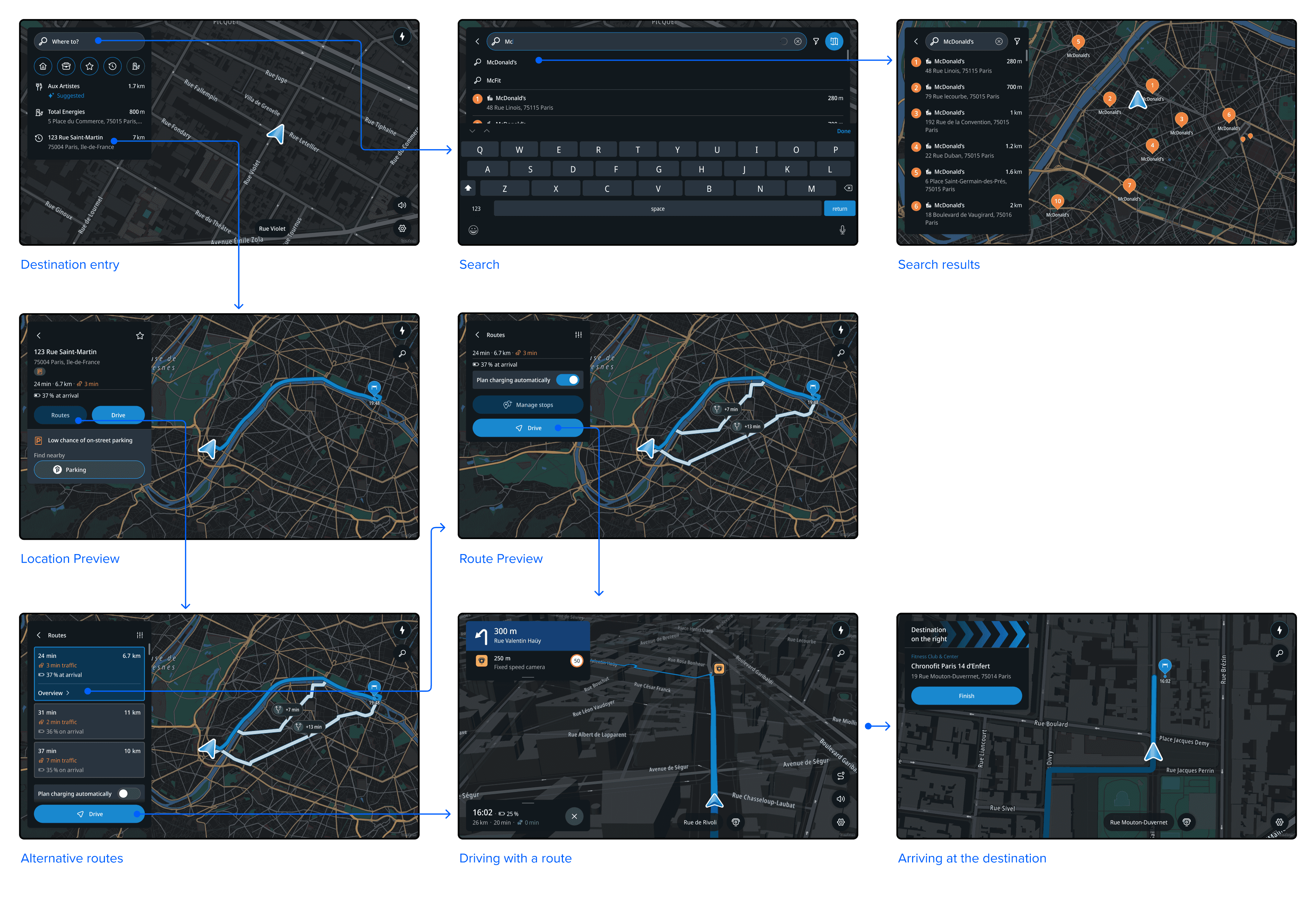
Destination entry
Destination entry is the starting point for all navigation functionality. It provides relevant information about a user’s location and their surrounding area. Common destinations can be quickly accessed for route planning.
From the destination entry panel, a user can:
- Start a free text search
- Plan a route to their home or work
- Go to a list of their favorite locations
- Drive to a recent or suggested destination
- Search for points of interest nearby
In addition, the home screen provides a map view of the area with traffic information.
On the map, there is a dedicated charging finder button as a shortcut to search for charging stations. This button is also available while driving.
Search
When starting a free text search, the keyboard slides up to reveal the field where the user can type their query.
Underneath the input field, there are shortcuts to popular POI categories and recent destinations — locations to which the user recently planned a route. These appear as chronological suggestions as long as no text has been entered. The most recently planned location appears at the top.
Free text search supports both address entry and point of interest (POI) search.

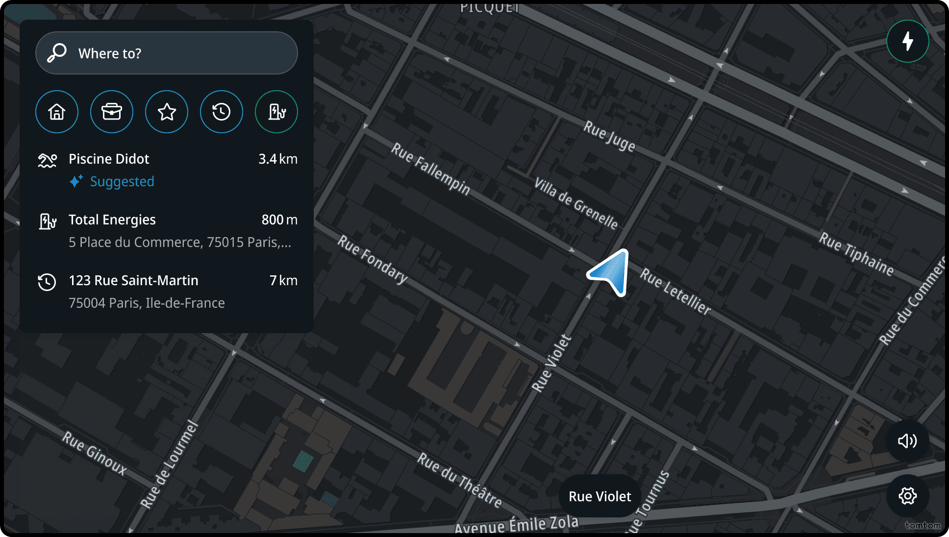
Search results
The results of a search are presented both in the panel and on the map. The map zooms out to accommodate the search results that appear in the list.
After the user taps “Show more” at the bottom of the list, it expands and the map zooms out further to display the additional results in the list and on the map.
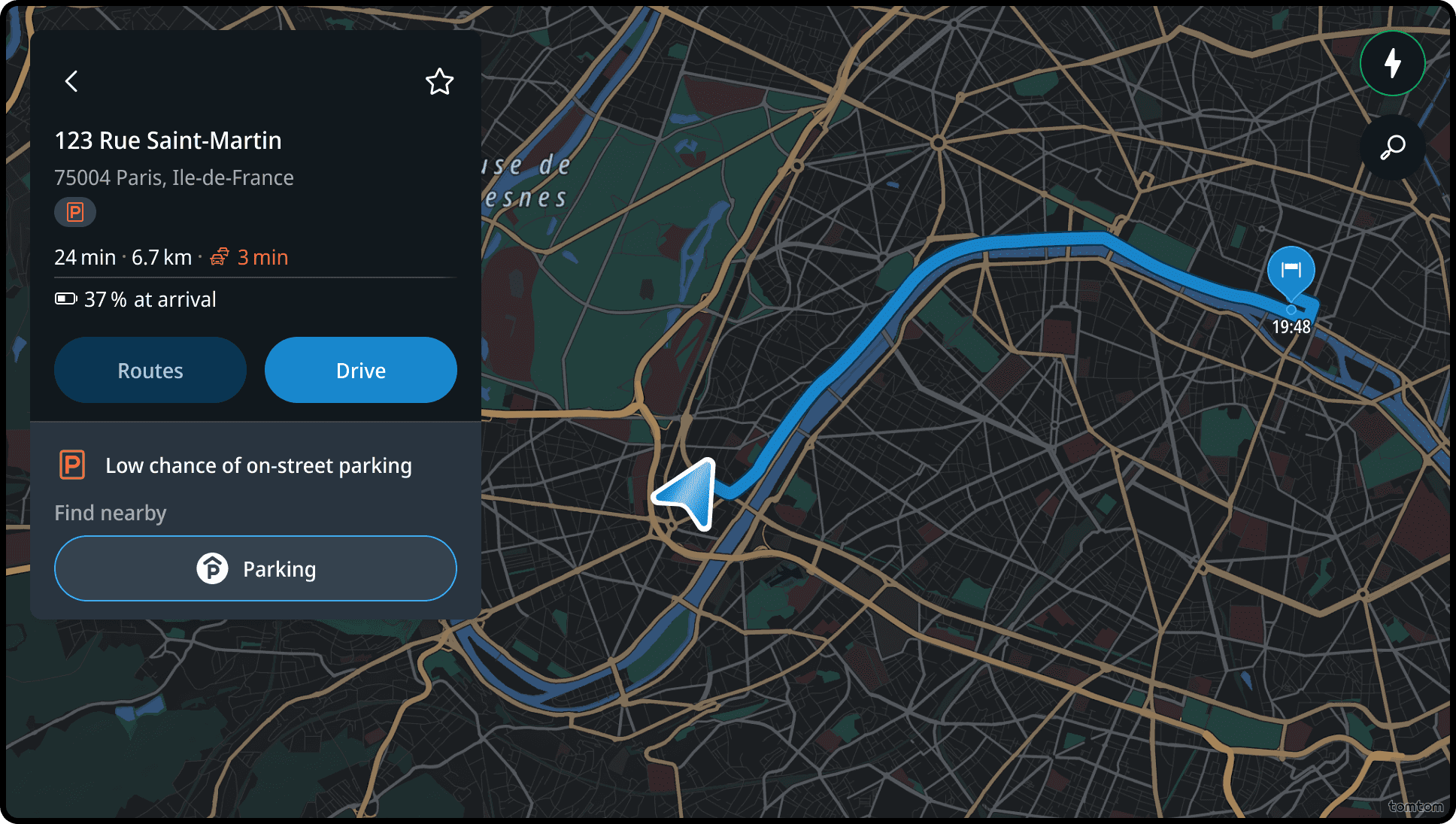
Location preview
For the selected location, the user sees basic information like address, distance, and a summary of their route. The location is also indicated on the map with a pin.
At this point, the user can:
- Start driving
- See more route details
- Find nearby parking
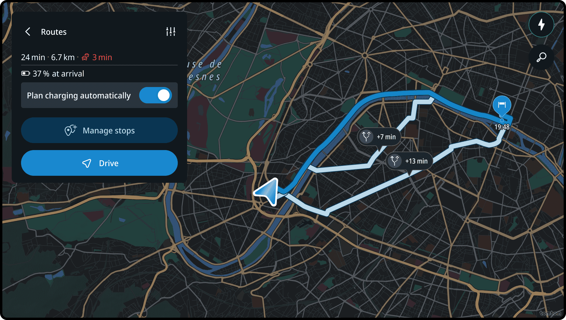
Route preview
Clicking the Routes button displays the proposed route and, when available, alternative routes.
More route information and optional waypoints are shown in the panel. On the map, the view zooms out to show the entire route.
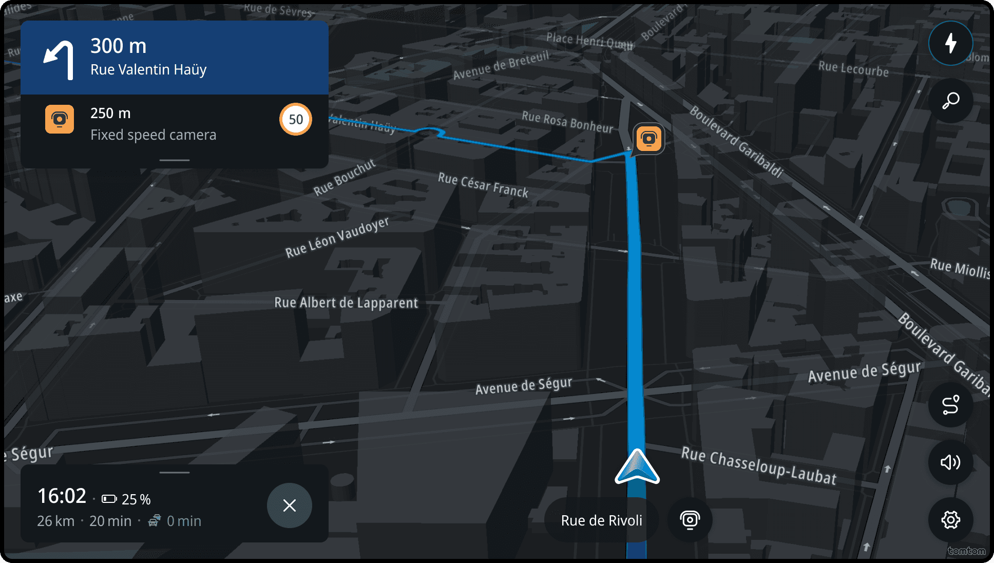
Driving with a route
The guidance view provides the user with detailed instructions (both visual and audio) alongside the route path on the map.
The map view automatically adjusts to keep the optimal route and upcoming maneuver in view.
Important upcoming events are displayed, such as:
- Speed cameras
- Rest areas
- Fuel/charging stations
These appear on the map and in the horizon panel.
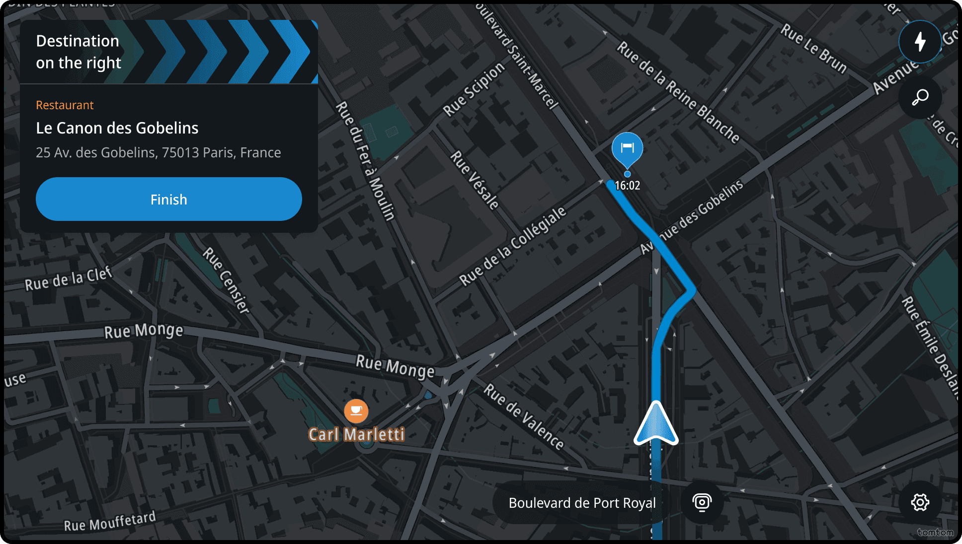
Arriving at the destination
As the user approaches their destination, destination information appears along with the direction to the location.
The map switches to a 2D north-up street-level view centered on the destination.
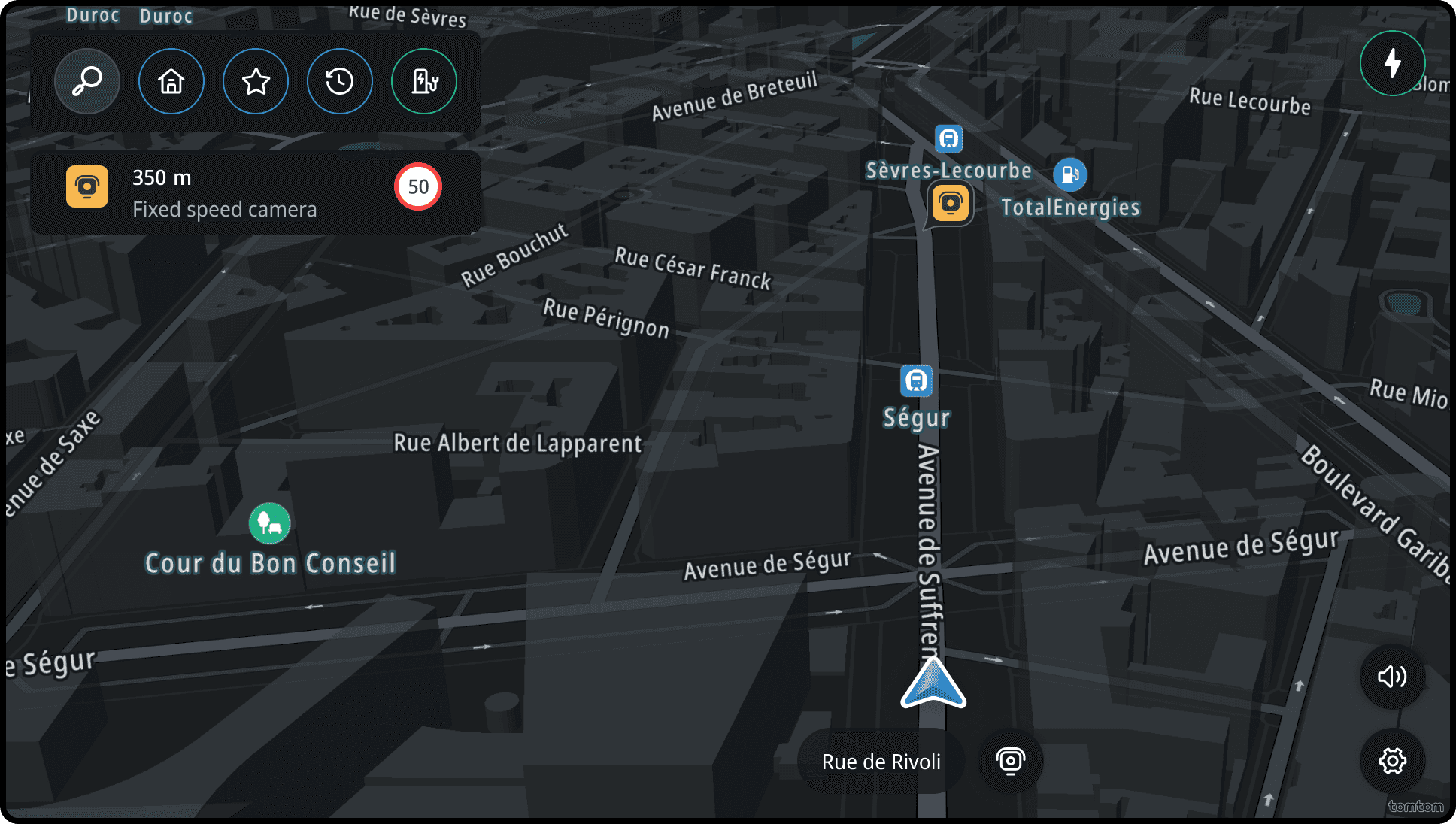
Driving without a route
The user can plan a route or choose to drive without one. When driving without a route, the map automatically adjusts after a while to optimize for that mode.
Flow
Driving to a destination
After setting a destination, users can navigate all the way to it without needing further interaction with the navigation application.