How Location APIs can help power Fleet Management Software
)
A basic knowledge of fleet management, logistics, and mobility is foundational for the creation of effective applications. We take a look at what fleet management software entails and how it can help you build great fleet tracking, management, and logistics applications.
We live in a mobile world. A healthy consumer appetite for the next big thing in on-demand services is also driving businesses across the spectrum to look for innovations that can help them deliver goods faster and cheaper, with more accuracy and greater reliability.
Today, location-based data is empowering marketing, mobility, and on-demand businesses like never before.
The availability of sophisticated, location-based solutions means developers have the opportunity to create applications that meet customer needs, increasing speed, accuracy, efficiency, and flexibility in existing business models… and maybe finding opportunities to build entirely new businesses and services powered by today's location technology.
For example, say your business delivers meals. Once upon a time, that might have been a few kids earning pocket change delivering pizzas, and if you got them to customers while they were still warm, you called that victory. But today you might have a fleet of dozens of drivers serving a network of restaurants. Your upscale clients expect fast delivery of hot meals and don't want to be left waiting by the door. Maybe you're thinking about expanding into delivering prescriptions and healthcare products for work-at-home customers as well.
These scenarios start to get pretty complicated quickly, coordinating orders, pickup locations, delivery addresses with entrances noted for driver convenience, efficient routes and accurate delivery times…. Fleet management applications can help with the tracking, management, and logistics of running an on-demand business like this.
It's easy to get lost in fleets, APIs, SDKs, routes, and so on. We took the time to break down what each term means for you and your project. Answers to such questions will help shape a fleet management solution whose capabilities are aligned with real business needs, and with a common language and understanding that will drive successful adoption and use of the technology.
Terminology Matters
TomTom provides a range of maps, traffic data, APIs, and associated software services that can help you create accurate and useful maps. And TomTom services encompass more than map making — location geocoding, geofencing, map display layers, routes, and point of interest are important components of a variety of maps that can be used for different business purposes.
Developers are primarily concerned with technical aspects of the solution, such as APIs, SDKs, and target platforms, including the web, iOS, and Android.
But the other side of application development involves mapping these technologies to key user concepts and requirements. On-demand, mobility, and other fleet-based businesses use some concepts and scenarios that may not be familiar to you as a developer. Let's break this down into some user requirements.
[Glossary of Fleet Management Software Terms:]{.underline}
Fleet ManagementLogisticsOn-demand and Last Mile DeliveryGeocoding and Reverse GeocodingGeofencingSpeed Limit DataSearchRoutingReachable Range[]Fleet management refers to a broad set of functions that help transportation-based businesses minimize risks associated with the ownership and operation of commercial vehicle assets. At a high level this may involve vehicle acquisition and disposal, optimizing operations to improve productivity, reducing vehicle and staff costs, or efforts to ensure compliance with government regulations regarding vehicle and driver safety.
Fleet management has transitioned from paper-based to digital systems to drive process improvement. For example, while advanced telematics now provide vehicle diagnostics, global mapping data and other geolocation applications help organizations track assets, monitor their behavior, and schedule fleet dispatch for optimal delivery and best use of assets.
[]Logistics, also known as fleet operations, is a subset of fleet management that focuses on the actual business of moving things around, whether the vehicles themselves or their cargo.
Based on onboard telematics, fleet logistics solutions enable functions such as vehicle tracking for asset monitoring, and to establish the most efficient route for a specific vehicle, taking into account inputs such as real-time traffic conditions, subsequent deliveries, distance to maintenance and fueling stations, cargo types, local road regulations, and even driver fitness for long-haul trips. Optimized routing can reduce operational costs.
[]On-demand and last mile delivery are critical concepts to some of today's fastest growing fleet-based businesses. What these businesses share is a focus on taking on-demand, time-sensitive customer requests — grocery and meal delivery, ridesharing, and courier services, typically within the customer's immediate area — and fulfilling the needs efficiently and on time. It's these businesses where location-powered software helps you connect all the dots: drivers, products, and customers.
With advanced on-demand fleet scheduling, routes and drivers can be quickly and efficiently assigned to deliveries, helping you optimize staff and ensure customer satisfaction. Route optimization, which identifies the most cost-effective route based on the shortest path between origin and delivery, taking into account fuel stops and multiple delivery scenarios, can also help to improve fleet productivity.
The ability to communicate information to drivers in real time, when they need it — often via mobile devices like smartphones — enables the flexibility that drivers and fleet managers need to quickly respond to traffic pile ups or collisions, or to adapt to new routing needs.
As these definitions suggest, fleet management, logistics, and on-demand delivery offer many options for operational improvement with the right location services: scheduling, including automated dispatch of vehicles based on specified parameters such as vehicle location and delivery points, traffic and congestion, speed limits, and other data.

Creating Applications for Fleet Management
Now that we've nailed down some of the high level requirements around fleet management, logistics, and on-demand delivery, how do you map these requirements to location-aware capabilities of a fleet management system you're asked to build?
More advanced fleet management applications can be built using location-based technologies provided by companies such as TomTom. Let's take a look at the kinds of location services developers can take advantage of to create an application for fleet management.
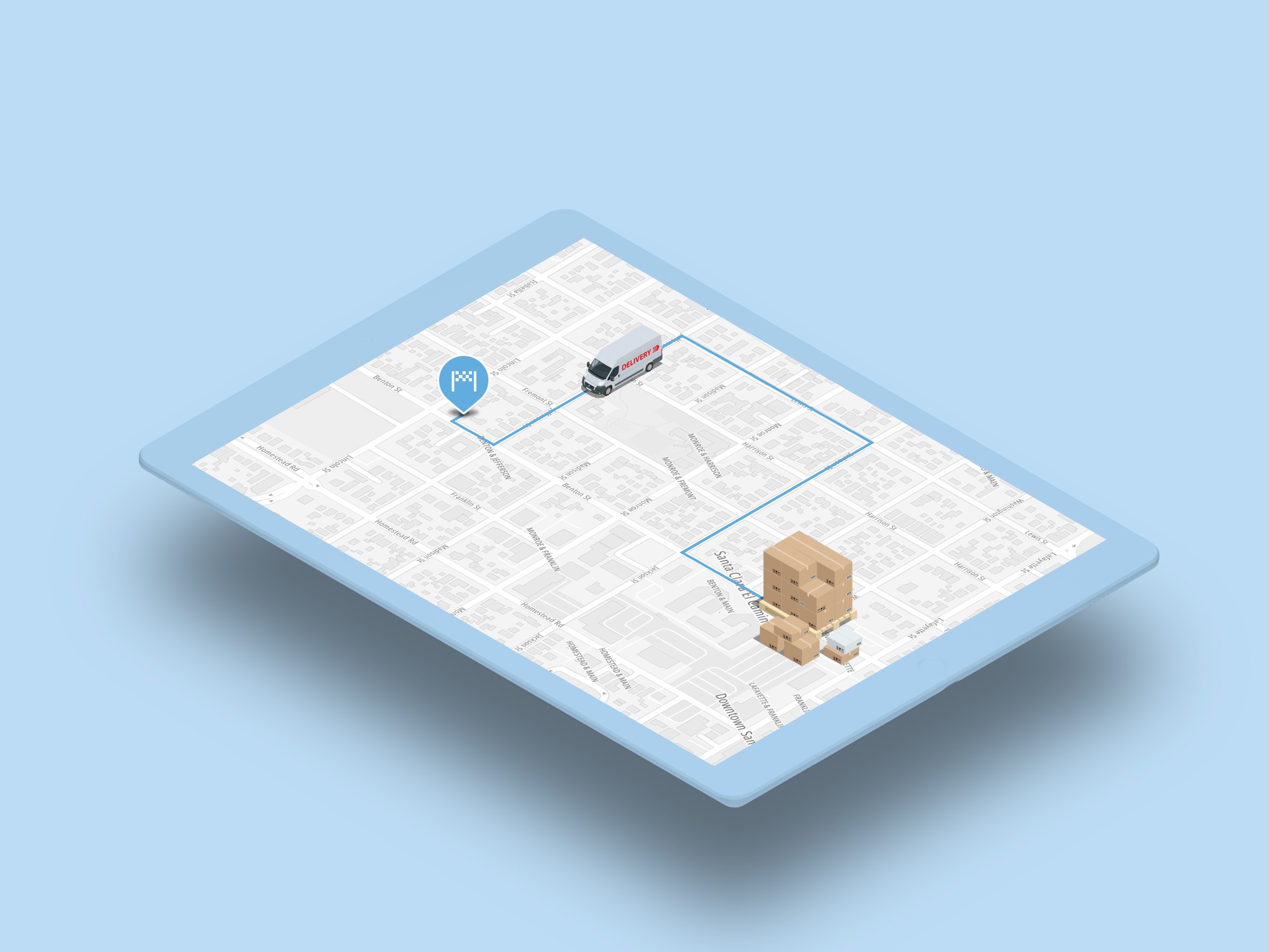
[]Geocoding and reverse geocoding services are used to pinpoint locations used for applications. That could mean turning a delivery address into coordinates that can be shown on a map, or providing a driver with the address and description of a point on her route, or letting a customer search for restaurants near their current location.
The TomTom Geocoding service is part of the Search API and translates input text, such as a street address, the name of place, or postal/administrative boundaries, into longitude and latitude coordinates for that location on the earth’s surface.
The Reverse Geocoding service is also part of the Search API and does the opposite: the conversion of geographic coordinates into a location, such as a street address — not just the street address, but also the road name, speed limits, side of road the driver should park on for easy delivery, closest intersection, mapcode, entrance location, and more.
This geocoding functionality is the bedrock of all mapping applications, and can be used in applications to help track fleet vehicles at a given point, their travel directions, and to calculate ETA to specific locations and send notifications when nearing a delivery, often in real time.
[]Geofencing lets developers use geolocation data to set up a virtual fence around a designated geographic area, by setting a radius or polygon fence around a specific location to predetermined boundaries.
The geofence is often created to monitor and control movement of vehicles. For example, you can use the TomTom Geofencing API to set a fence within a kilometer of a delivery address to generate alerts to the customer that a hot meal is about to arrive — wait for that knock on the door — or to notify the fleet manager that the driver is moving on to the next job. You can even use it to note if a vehicle strays beyond the permitted work area.
[]Speed limit data, which may vary by jurisdiction, can be displayed on vehicle navigation devices, allowing fleet management software to help prevent speed limit violations, avoiding costly fines and reckless driving behavior, as well as control fuel costs. For example, the TomTom Search API and Routing API (discussed below) return speed limit data, which could be displayed for drivers in an application.
[]Search lets you find a destination fast and accurately. TomTom's Search API also returns entry points, which are very valuable for delivery efficiency.
[]Routing is a key capability of fleet management software, establishing the best path between origin and destination points. TomTom’s Routing API allows you to take into account specified points of interest, such as truck stops, and additional parameters, such as traffic and collisions to avoid – as well as required departure and arrival times — to define the optimal pathway.
Routing calculations can be called in batches, either in asynchronous mode, which enables the processing of large volumes of complex requests, or in synchronous mode, which responds to simpler routing requests, such as changing traffic conditions, with results that expire quickly. The TomTom routing engine also supports matrix routing, a matrix of route summaries for a set of routes with defined start and end points. Call results provide time and cost calculations for various matrix options.
[]Reachable range, provided by the Routing API Reachable Range, allows you to calculate how far your fleet can go on a route based on configurable parameters such as vehicle type, time, traffic, geography, and fuel or energy budget (including custom consumption models).
These TomTom APIs and services — along with many other capabilities provided by TomTom APIs and SDKs — can be the building blocks of your fleet management applications. You can call the APIs directly from back end systems, use the TomTom Maps SDK for Web to build web-based applications with sophisticated map display options, or build mobile applications with the Maps SDKs for Android and iOS.
Next Steps
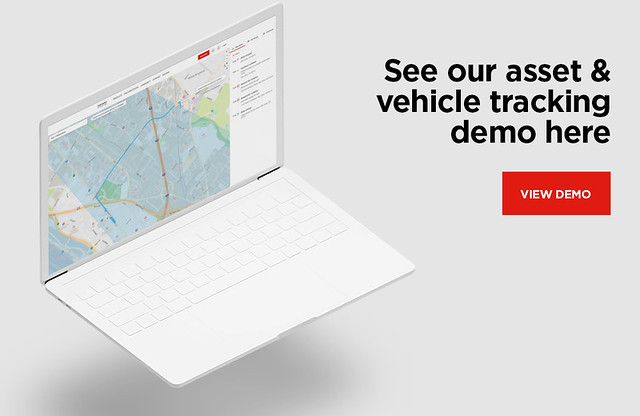
To understand how you can bring these possibilities to life for your organization using TomTom’s APIs, consider a test drive. Register for a free TomTom developer account for API keys, check out the functional examples for ideas of what you can build with TomTom, and contact us to speak to an engineer to get started.