What is Fleet Tracking?
) Ruanna Owens
Ruanna OwensKnowing where each vehicle is at any given time can assist with fleet scheduling, route optimization, and fuel consumption management. TomTom helps build fleet management solutions by providing location and routing information to developers through easy-to-use APIs.
Real-time fleet tracking allows users to know where a vehicle is at any given point in time, past or present. Combined with other data, such as routing and traffic information, real-time fleet tracking provides valuable insight into estimated time of arrival (ETA), vehicle range, and more.
Knowing where each vehicle is at any given time can assist with fleet scheduling, route optimization, and fuel consumption management. It can also ensure that just-in-time-delivery and service-level agreements are met. In short, vehicle tracking provides logistics professionals with the information they need to make practical real-time decisions.
What are the components of fleet tracking?
When we look at fleet management, we are looking at optimizing vehicle use for a specific purpose. This purpose could be freight delivery or long-haul delivery from a factory to distribution centers. Or it could be picking up food from a restaurant and delivering it to a customer's home while it is still hot.
In some cases, like postal services, fleet management may help you keep an eye on a dedicated fleet that operates from a central location or services one specific area, returning upon completion of each delivery. In other cases, such as food delivery services with independently contracted drivers, it may manage vehicles that service multiple pickup and delivery locations. Regardless of what the objective is, the capabilities of fleet tracking play a fundamental role in maximizing fleet efficiency.
Fleet GPS tracking is central to any fleet tracking system. This technology uses GPS to monitor location, travel direction, and speed. Fleet GPS tracking is primarily used to monitor a collection of vehicles, but can also track drivers and other assets, such as packages. Telematics software monitors GPS position and other information, such as fuel consumption. Telematics collects and relays this information in real time so it can be used to make decisions.
Fleet vehicle tracking provides active monitoring of a fleet by consolidating information from each individual vehicle into a single view. This view provides fleet managers with the ability to visualize and interpret information about their entire fleet. Fleet managers can zoom in or out on a given map area to understand the speed of travel and ETA, allowing them to make decisions that will avoid contention at a pickup or delivery site.
On-board diagnostics (OBD2) fleet tracking monitors fuel consumption, vehicle systems status, and vehicle maintenance. It also tracks driving patterns, such as braking, acceleration, and idling.
Combined with location and routing information, OBD2 fleet tracking can answer questions for the fleet manager. For example:
Is the vehicle obeying the speed limit, or taking mandated breaks?
Is the vehicle deviating from the designated route?
If the vehicle is coming due for maintenance, when and where should that occur?
OBD2 fleet tracking allows the fleet manager to avoid costly mistakes by monitoring all these factors for the entire fleet of vehicles.
Heavy goods vehicle (HGV) tracking refers to truck and lorry tracking. While fuel consumption is always a concern in fleet management, it is especially important in HGV management, because fuel tends to make up a large percent of HGV operating costs. Fuel costs can be mitigated by monitoring and altering a variety of driver behaviors, such as acceleration, braking, and speed. Where applicable, it can also impact VAT taxes and fines.
Vehicle Tracking Software
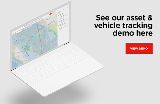
There are several types of vehicle tracking software available on the market. Each allows users to answer a different set of questions. They share the ability to gather a variety of vehicle and location data and transform it into critical information for managing a fleet of vehicles. To see TomTom’s technology in practice, check out this asset and vehicle tracking demo.
Vehicle tracking software can provide any combination of these features:
Real-time vehicle location and movement data provide basic information on a vehicle's speed, direction of travel, and location. With this data, fleet managers are able to see not only where vehicles are, but where they are in relation to each other and in relation to the environment around them (on the highway, in a business district, and so on). If a driver reports a traffic incident, managers need to understand which other drivers may be affected and communicate with them to mitigate the situation.
Geocoding and routing is the primary function of understanding where vehicles and their destinations are — geocoding locations to mappable coordinates — and the routes between the two locations. It determines the shortest time between pick up delivery, optimizing efficiency for both individual vehicles and entire fleets.
Tracking for package delivery confirmation gives users real-time information on the location of a truck carrying a specific package. GPS location confirms that a vehicle arrived at its delivery location and provides proof of time spent stopped. This information, combined with photographic or signature acknowledgment, demonstrates evidence of delivery.
Driver tracking features focus on driver behaviors such as exceeding speed limits, changing lanes frequently, and going off route. By tracking a vehicle's location and speed and comparing it to local conditions, developers can create software that both details and summarizes drivers’ behavior. Knowing this information can help to avoid accidents and lower experience-based insurance premiums. Monitoring drivers can discourage them from going off route, reducing a costly behavior that consumes both time and fuel. Real-time vehicle monitoring provides the data necessary to perform an analysis to improve fleet logistics.
Detecting delivery or pickup/dropoff patterns refers to tracking the time spent loading or unloading a vehicle at a given location. Through real-time monitoring and GPS mapping, we can determine information such as the time spent at a location, the location type (for example, a retail store or wholesale distributor), or the time spent idling. These elements contribute to the cost of service for a given customer, set of customers, or area.
Stolen vehicle recovery becomes far more manageable with real-time tracking of the vehicle’s location. This information can be shared with law enforcement to seamlessly transmit location, speed, and direction, assisting in timely recovery. Recovery is time sensitive, since not only the vehicle but also the goods onboard are at stake.
Instant alerts based on location allow users to stay up-to-date on valuable location-based information**.** A geofence is a virtual polygon that can be centered around any location or vehicle. Its radius is determined by factors such as distance or driving time. Alerts can be triggered when a vehicle enters or leaves a geofenced area. This information is valuable in reducing pickup or delivery time. For example, a warehouse can be alerted when a vehicle is 30 minutes away. This creates an opportunity to prepare forklifts and crews in advance, reducing unloading time.
Building Vehicle Tracking Systems with TomTom
Each of these vehicle tracking use cases is dependent not only on the onboard vehicle GPS, but also on extensive mapping, geocoding, and local temporal conditions (traffic, accident, construction, and so on). TomTom collects, organizes, and maintains this data and provides it to the developer through APIs. Calls to these APIs within an application return the desired information in a compatible, user-friendly format.
TomTom Routing provides the developer with real-time and historical traffic and road data to optimize routes for desired requirements. These requirements may include avoiding tolls, limited-access highways, or routes where hazardous goods are prohibited. The TomTom Routing API supports various vehicle types including trucks and electric vehicles (EV) for fleet operations. TomTom can track range, charging requirements, and charging locations within a geofenced area.
TomTom Geocoding and Reverse Geocoding enable easy translation between human-readable addresses and mappable coordinates for locations. Processing behind location services, routing algorithms, and map display technology all relies on coordinates that describe unique locations on the Earth. But these coordinates aren't what customers enter into an order processing app, nor are they useful for a delivery driver looking for the right house to make a delivery. The TomTom Search API enables easy translation between addresses and coordinates to power your applications.
TomTom Geofencing and Notifications allows users to designate a virtual polygon around a location or vehicle. Its radius may be specified by distance, travel time, or vehicle range.
Developers may use geofencing to provide alerts for a variety of situations. As described in the earlier example, an alert may be sent to a destination to prepare for delivery. Additionally, an alert may be sent to a fleet manager if a driver deviates a designated service area or routing corridor.
TomTom Location History works in conjunction with geofencing and vehicle tracking to analyze and plan fleet movement. Location history provides data on where vehicles are at any given point in time. Are vehicles more active in one part of the town than another? This data is valuable, especially when timely service is required. It provides the fleet manager with the information they need to stage vehicles where they are most needed. The Location History API provides information that improves planning for future trips, allowing managers to optimize routes and avoid deadheading.
TomTom's APIs allow developers to easily incorporate these features and more into their fleet management software. Learn more about the TomTom tracking family of APIs in the video below:
Next Steps
TomTom provides developers with real-time tracking and mapping information, allowing them to incorporate powerful features into their fleet management software. TomTom's APIs support web, iOS, and Android environments.
To learn more, visit TomTom Fleet Management and Logistics. For more details on using TomTom’s APIs, visit the developer portal and register for your login. The asset and vehicle tracking demo is a great showcase for understanding how these technologies work together. For inquiries, contact TomTom.