Meet the Women Mapping the World: Part 1
) Ruanna Owens
Ruanna Owens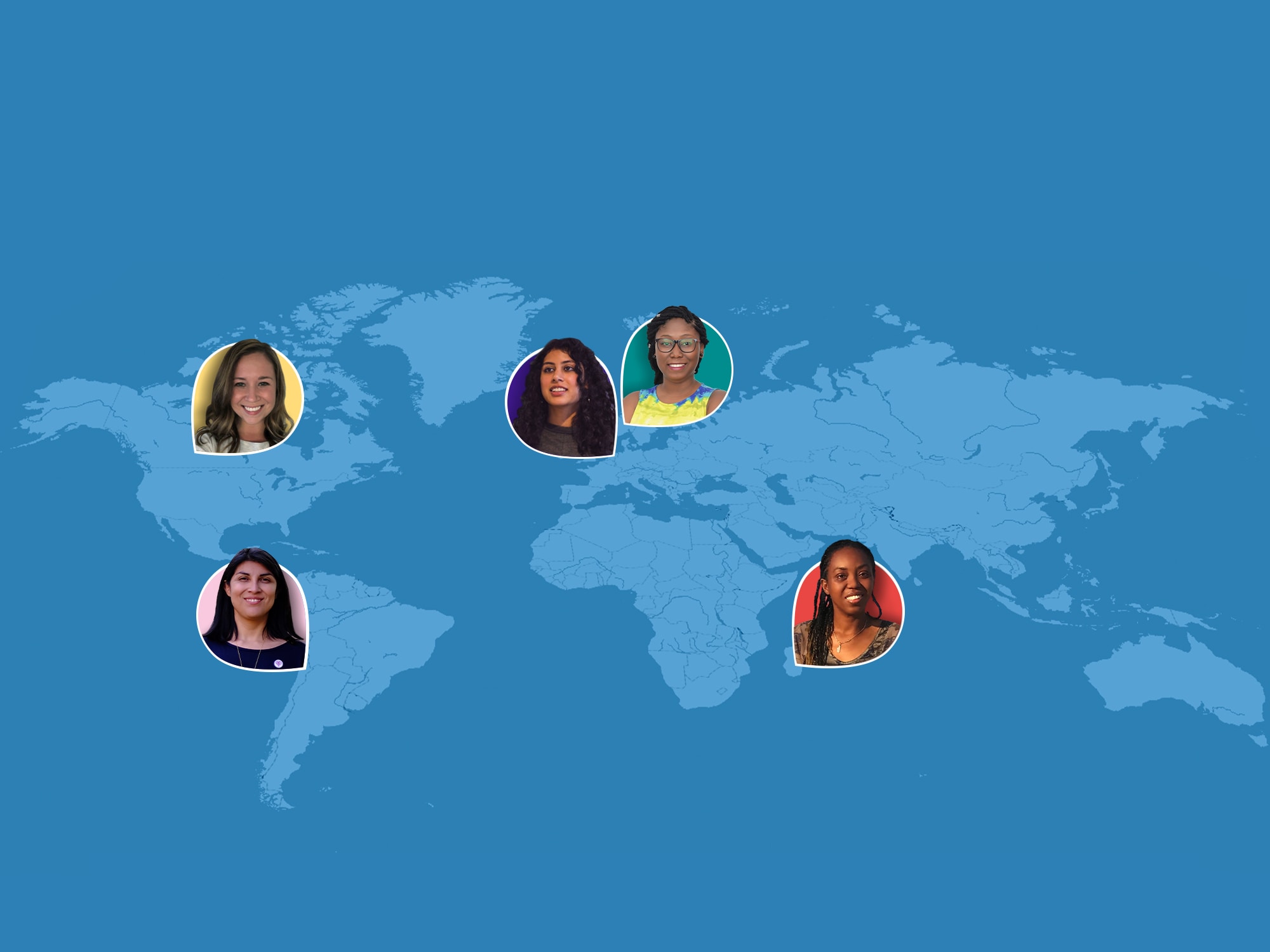
In honor of International Women’s Day, we interviewed women in GIS across the globe to hear about what they’re working on, their thoughts on the future of mapping, and the importance of diversity in geospatial.
Celebrating International Women's Day at TomTom Developers
To celebrate International Women’s Day this year, we are highlighting women who are doing awesome things in the GIS and geospatial space in a two-part blog series. Women are underrepresented in STEM fields and there is still much ahead to change – and it all starts with awareness. Keep reading to learn more about the career paths and thoughts on the future of mapping from five awesome women in geospatial.
Meet the Women
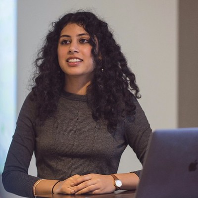
Deboleena Mazumdar, Data Scientist, TomTom
Amsterdam, The NetherlandsDeboleena is a data scientist for the AmiGo team (in Apps and Web) at TomTom. Her day-to-day tasks include ensuring the right data is being collected, analyzing the data to derive insights, and sharing insights with stakeholders in a digestible way.
 What are your career goals for the future?
My north star has always been to use data to enable better decision-making in cities. There is so much to love about urban living - the dynamism, diversity, the sense of belonging to something much bigger than yourself. But there is also so much work to be done! Especially in terms of sustainable mobility, access to affordable housing, and urban health and safety, which are principles that are pretty universal across cities.
Ensuring that we ask the right questions, involve diverse stakeholders, collect the right data and use it to have an impact is a big challenge. My goal is to be the link between the numbers and the actions that makes urban living better for all residents.
How can we grow the field of GIS and mapping with more women in mind?In the past when a lot of the underlying technology for GIS was proprietary, it was harder to enter this field without a formal affiliation to a university or company. Even if you had the opportunity to take a course, maybe you would be less likely to take it because you didn’t know other women who had pursued this path or what you could do with it.
With the growth in open-source tools, the barrier to entry has somewhat reduced. We need to capitalize on this shift by being visible and being vocal, as a group. Things like the 30 Day Map Challenge (started by Topi Tjukanov) create a creative community from which to gain inspiration and learn about new tools in a low-stress way, while honing your skills. Networks like Women in Geospatial offer tutorials, mentorships, and opportunities to see and connect with women thriving in this field.
Cyhana Lena Williams, UX Researcher, Microsoft, & Co-Founder of African Women in GIS
Oslo, NorwayCyhana focuses on user experience research in software design and development, helping bridge the gap between product teams and customers using different research methods and programs. She is also the Co-founder of African Women in GIS – an online community for African women around the world who are working, studying or are enthusiasts of the Geospatial industry.
 What does the future of mapping look like to you?
I see the future of mapping to evolve to a degree that will make it the heart of operation for most industries all over the world. Analyzing location and creating intelligence with it will be critical in the formation and sustainability of most industries. The full potential of mapping has not yet been fully realized.
How can we grow the field of GIS and mapping with more women in mind?The most obvious answer that comes to mind is awareness. However, how, where and who is to create that awareness becomes the issue.
Who: I believe that each person in the industry and even outsiders who know about the field are responsible for helping encourage interested women to pursue GIS. We need to encourage and support communities that are helping to bridge that gap.
Where: We need to start with children in schools, especially in developing countries. Growing up, I was exposed to a limited number of career options and that made me scared and confused because I felt that I did not belong to career paths such as doctors or lawyers. My exposure to possibilities and options were limited.
How: Creating career exposure opportunities as well as mentorship programs can help give young girls an idea of the possibilities that await them. Encouraging parents to allow their children to try out interested fields can make career decisions easier. Some young girls have the interest, but are blocked by either their parents or limited exposure. Basically, we have a lot to do in that regard.
You can read more about Cyhana’s career journey here.
Jaime Hutton, Senior GIS Engineer, TomTom
Ontario, CanadaJaime is a Senior GIS Engineer on the Data Technology Team in North America, with a background in environmental science, natural resource management, and GIS. She works on regional and global projects that process, analyze, and deliver data sources that add value to TomTom’s mapping products, focusing on back-end tool development using Python/Postgres-based solutions.
 What was a career-defining moment for you?
When I decided to explore the more technical side of the industry, I was lucky to be involved in a mentorship program and joined a small sub-team. The team was led by a highly accomplished, senior-level female engineer who guided the team to many opportunities, and I began to build my skill set through company-specific objectives and outputs. This experience changed the trajectory of my career, but moreover taught me the value of mentorship: learning from your peers, creating opportunity, and feeling supported. Since then I’ve been involved in other rewarding mentorship programs, where I am on the other side, providing support to those looking to grow.
How can we grow the field of GIS and mapping with more women in mind?I think diversity needs to be intentional and it needs to start at the top. A company’s leaders must be invested (and set benchmarks) in ensuring representation of women in all levels of an organization. Furthermore, expanding inclusivity to any underrepresented group. Creating equal opportunity comes from being diverse in the selection of candidates for new hire or internal promotions. We often say we will hire the “most qualified person for the role.” And there is merit in that. But I also think we should purposefully build teams with a diversity in mind, understanding the substantial benefits that come from having an array of perspectives and experiences.
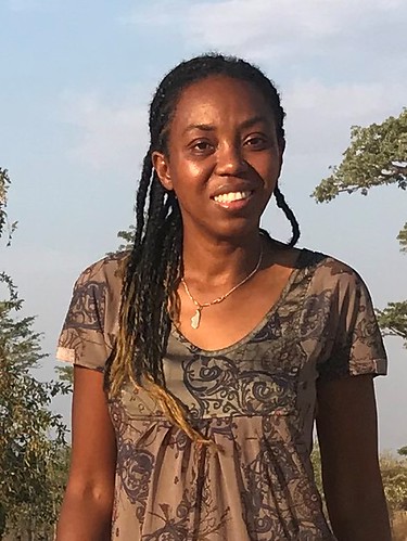
Angela Tarimy, Project Management Coordinator, Project Manondroala
Antananarivo, MadagascarAngela is a project manager and coordinator of the nature conservation project implemented in Madagascar called Project Manondroala - focused on protecting, restoring and monitoring natural forests in Madagascar. She is also an authorized GIS instructor of Juniper GIS Services, Inc. through the Society for Conservation GIS.
 Can you share a little about your career path?
With my Master’s degree in Economics at the University of Antananarivo, I was an assistant of the monitoring and evaluation responsible for the AIDS program in Madagascar for a year. My role was to investigate what data was relevant to collect, using GIS, in order to monitor the contamination rates and the effects and impact of interventions.
Then I worked in a poverty alleviation program for five years, funded by the European Union. Madagascar is a megadiverse country with a high concentration of endemic species and I realized that one of the powerful resources for Madagascar to reach the sustainable development goals is its very unique biodiversity. Supports from all were needed for the country to take better advantage of the benefits from its own biodiversity and ecosystem services. So, I decided to bring my contribution to nature conservation activities as a project coordinator for Manondroala.
How can we grow the field of GIS and mapping with more women in mind?Introducing GIS/geospatial and mapping at different types of events (GIS Day, workshops, trainings) will inspire people, pointing out that the participation of women is very welcome. In the case of Madagascar, the lack of access to equipment (computer, electricity, internet, GPS to collect data) can be a factor of blockage. However, supporting educational institutions such as schools, universities, and libraries may improve the access.
Karin Paz Guentelican, Geographic Sourcing Analyst, TomTom
Santiago, ChileKarin’s role consists of searching, creating and evaluating sources for Latin American countries. This includes analyzing solutions for sourcing activities, source acquisition and source quality checks, and providing inputs in order to keep TomTom maps updated.
 Can you share a little about your career path?
I studied geography at a time when this career wasn't well known to the people in Chile. Even I knew very little – so my family was surprised when I decided to study and embark on this career path. I had a friend who studied geography in a different university, and she would share what she was learning with me. I loved everything about it – the tech part, the map part, the social and environmental areas – geography embraces a lot of subjects and I loved that it wasn’t just one simple area to specialize in.
How can we grow the field of GIS and mapping with more women in mind?Show the world our perspective. How women see and experience the world is so different, even culturally, and if we as a company include maps under this topic, we are going to find that sometimes women do take the safer road, or drive slower to be safe, or that women bikers need to identify secure travels: think well-lit areas, open spaces, etc. These things can make more women use the products and that means we are going to need more women in the design teams, in the maps, etc.
In technology, just as in designing a map, sometimes we’re not seeing it through the user. The designer is also a user – and if the majority of designers are men, for example, they’re designing map information as they themselves are a user of it – so some of these issues around safety and navigation may never occur to them. It’s not their fault, but we can only see what we experience ourselves. So we need more women designers, engineers, etc. making decisions.
Next Steps
To learn more about what opportunities we have at TomTom, check out the links below:
To explore other mapping, GIS, and tech communities committed to diversity and representation, check these organizations out:
Women in Geospatial – A professional network to promote gender equality in the geospatial industry & academia.
r/girlsgonewired – an online community on Reddit of over 20K women in tech with discussions on career advice and more.
Black Girls M.A.P.P. – Celebrating & connecting marginalized communities; using GIS to investigate social issues & empower change.
GeoLatinas – Embracing, empowering, and inspiring Latinas to pursue and thrive in careers in Earth and Planetary Sciences.
NorthStar of GIS – A community group working to increase representation, belonging, and inclusion of people of African descent in GIS.
African Women in GIS – an online community that gives African women the freedom to create connections, gain mentors, learn new skills, access courses, and get job-related advice and opportunities.
Did we miss any communities? Share your favorites on Reddit at r/tomtom or the TomTom Developer Forum.
To get started mapping on the TomTom Developer Portal, sign up for your free account and API key.
Read part 2 of this series here!Happy mapping!